Bingumer Sand
Located in Lower Saxony, Germany Coordinates: 53°13′43″ N 7°25′04″ E
- Elevation
- -1 m
- above sea level
- Local time
- UTC+01:00
- Europe/Berlin · UTC+01:00
About Bingumer Sand
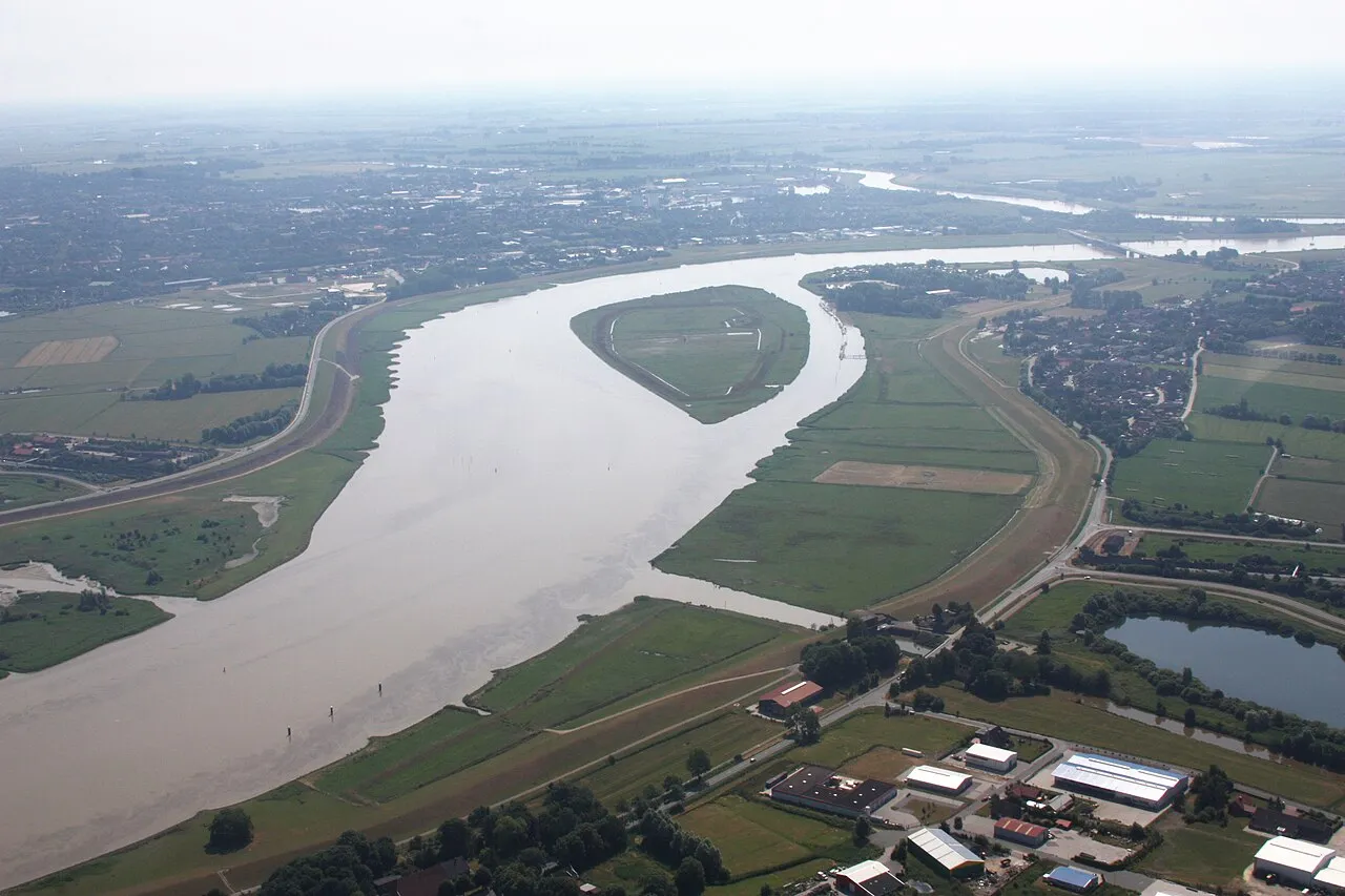
Bingumer Sand is an island. Location: Lower Saxony, Germany.
Bingumer Sand is a small river island in the Ems off the Rheiderland shore near Bingum in East Frisia. It is part of the Emsauen zwischen Ledamündung und Oldersum nature reserve. Not far from the Bingumer Sand is the Jann Berghaus Bridge.
Read more on Wikipedia Text: Wikipedia contributors · CC BY-SA 4.0 · shortened
In comparison
- 10 sights and natural places within 10 km Leda, Fernmeldeturm Leer - Nüttermoor
Nearest towns and villages
-
Landkreis Leer Municipality, Lower Saxony4.1 km NE
-
Leer (Ostfriesland) Village, Landkreis Leer3.9 km E
-
Bingum Neighbourhood, Leer (Ostfriesland)0.9 km SW
-
Leer Town, Leer (Ostfriesland)2.9 km E
-
Jemgum Village, Landkreis Leer4.8 km NW
-
Leerort Village, Leer (Ostfriesland)1.7 km SE
Nearby attractions & nature
Everything nearby-
Leda River, Lower Saxony2.1 km S
-
Naturschutzgebiet Emsauen Natural site, Jemgum6.6 km N
-
Flachsmeer Lake, Lower Saxony7.5 km NE
-
Fernmeldeturm Leer - Nüttermoor Landmark, Leer (Ostfriesland)4.1 km N
-
Wolfmeer Lake, Lower Saxony8.8 km NE
-
Naturschutzgebiet Wolfmeer Natural site, Moormerland8.8 km NE
-
Hatzumer Sand Island, Moormerland9.6 km NW
-
Kloster Thedinga Attraction, Leer (Ostfriesland)5.2 km NE
Sources & licences
Data last updated: · 2 independent sources