Leda
Located in Lower Saxony, Germany Coordinates: 53°12′36″ N 7°25′28″ E
- Elevation
- -2 m
- above sea level
- Local time
- UTC+01:00
- Europe/Berlin · UTC+01:00
About Leda
Leda is a river. Location: Lower Saxony, Germany.
In comparison
- 7 sights and natural places within 10 km Bingumer Sand, Fernmeldeturm Leer - Nüttermoor
Nearest towns and villages
-
Landkreis Leer Municipality, Lower Saxony5.2 km NE
-
Leer (Ostfriesland) Village, Landkreis Leer4.4 km NE
-
Leerort Village, Leer (Ostfriesland)0.6 km NE
-
Bingum Neighbourhood, Leer (Ostfriesland)1.5 km NW
-
Esklum Village, Westoverledingen1.2 km E
-
Leer Town, Leer (Ostfriesland)3.4 km NE
Nearby attractions & nature
Everything nearby-
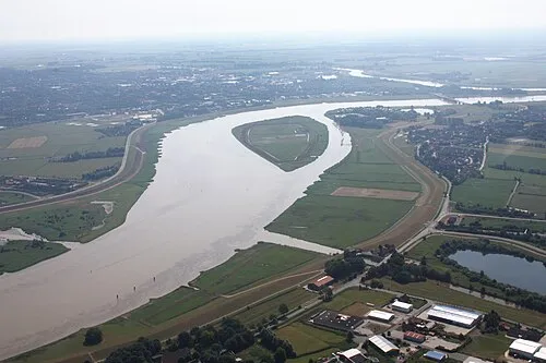 Bingumer Sand Island, Lower Saxony2.1 km N
-
Jümme River, Lower Saxony6.9 km E
-
Heester Tief River, Lower Saxony8.7 km W
-
Flachsmeer Lake, Lower Saxony9.1 km NE
-
Kajentief River, Lower Saxony18 km NE
-
Wolfmeer Lake, Lower Saxony10 km NE
-
Kapellentief River, Lower Saxony19 km NW
-
Naturschutzgebiet Emsauen Natural site, Jemgum8.7 km N
Sources & licences
Data last updated: