Campen
Located in Lehre, Helmstedt (district) Coordinates: 52°21′09″ N 10°42′30″ E
- Local time
- UTC+01:00
- Europe/Berlin · UTC+01:00
- Elevation
- 83 m
- above sea level
About Campen
Campen is a historic site. Location: Lehre, Helmstedt (district).
In comparison
- 25 sights and natural places within 10 km Kampen, Staatsforst Lehre
Nearby attractions & nature
Everything nearby-
Kampen Historic site, Lehre0.1 km SE
-
Staatsforst Lehre Natural site, Lower Saxony2.2 km S
-
Beienroder Holz Natural site, Lower Saxony2.2 km S
-
Hülsenberg Mountain, Lehre4 km S
-
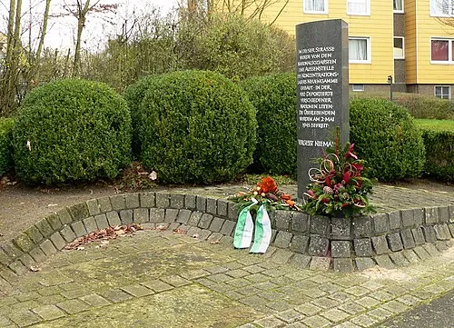 Wolfsburg-Laagberg Concentration Camp Historic site, Wolfsburg7 km NE
-
Hohnstedter Holz Natural site, Lower Saxony3.5 km N
-
Dingelberg Mountain, Wolfsburg4 km E
-
Hauptsendemast Cremlingen Landmark, Cremlingen6.7 km S
Nearest towns and villages
Sources & licences
Data last updated: