Berumbur
Located in Landkreis Aurich, Lower Saxony Coordinates: 53°35′21″ N 7°18′40″ E
- Population
- 2,688
- 2.7K
- Elevation
- 0 m
- above sea level
- Local time
- UTC+01:00
- Europe/Berlin · UTC+01:00
- Places inside
- 4
- listed under Berumbur
About Berumbur
Berumbur is a village. Location: Landkreis Aurich, Lower Saxony. Population: 2,688. Elevation: 0 m.
Berumbur is a municipality in the district of Aurich, in Lower Saxony, Germany. It is part of the municipal association (Samtgemeinde) of Hage. In 2022 it had approximately 2,700 inhabitants and covers an area of 6.42 square kilometers. It is east of the town of Hage. The municipality includes the districts (Ortsteile) Kleinheide and Holzdorf. Directly to the west of Berumbur is Berum, home to Berum Castle, which played a prominent role in East Frisian history.
Read more on Wikipedia Text: Wikipedia contributors · CC BY-SA 4.0 · shortened
At a glance
- Area
- 6.4 km²
Source: Wikidata
In comparison
- No. 14 of 24 places in Landkreis Aurich by population
- Nearest larger town: Hage, Flecken, 2 km N
- 22 sights and natural places within 10 km Burg Berum, Schloß Nordeck
- Listed here: Village: 4
Places in Berumbur
4 places-
Berumbur Village2.6K
-
Berum Village
-
Holzdorf Village
-
Kleinheide Village
Nearby attractions & nature
Everything nearby-
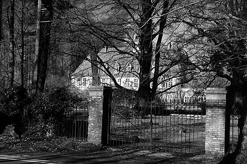 Schloß Nordeck Historic site, Hage, Flecken1.9 km NW
-
Burg Berum Historic site, Hage, Flecken1.6 km NW
-
Großes Holz Natural site, Lower Saxony2.8 km W
-
Thunschloot River, Lower Saxony3.1 km N
-
Nordholz Natural site, Lütetsburg4 km NW
-
Tidofelder Holz Natural site, Lower Saxony4.9 km W
Sources & licences
Data last updated: · 2 independent sources