Landkreis Aurich
Located in Lower Saxony, Germany Coordinates: 53°29′32″ N 7°18′50″ E
- Population
- 188,816
- 188.8K
- Elevation
- -1 m
- above sea level
- Local time
- UTC+01:00
- Europe/Berlin · UTC+01:00
- Places inside
- 28
- listed under Landkreis Aurich
About Landkreis Aurich
Landkreis Aurich is a municipality. Location: Lower Saxony, Germany. Population: 188,816. Elevation: -1 m.
In comparison
- No. 11 of 47 places in Lower Saxony by population
- 22 sights and natural places within 10 km Engerhafe Concentration Camp, Victorbur, St. Victor-Kirche
- Listed here: Village: 24, Natural site: 4
Places in Landkreis Aurich
28 places-
Aurich Village42.6K
-
Norden Village25.2K
-
Südbrookmerland Village18.4K
-
Großefehn Village14K
-
Wiesmoor Village13.9K
-
Ihlow Village12.4K
-
Krummhörn Village11.4K
-
Großheide Village8.3K
-
Hinte Village7.3K
-
Hage, Flecken Village6.5K
-
Norderney Village5.3K
-
Dornum Village4.4K
-
Upgant-Schott Village3.6K
-
Berumbur Village2.7K
-
Marienhafe, Flecken Village2.5K
-
Osteel Village2K
-
Rechtsupweg Village2K
-
Leezdorf Village1.8K
-
Juist Village1.1K
-
Halbemond Village962
-
Wirdum Village999
-
Lütetsburg Village728
-
Baltrum Island Village471
-
Hagermarsch Village415
-
Haaksdünen Natural site
-
Norddünen Natural site
-
Nordklipp Natural site
-
Schillhörn Natural site
Nearby attractions & nature
Everything nearby-
Schiffleide River, Lower Saxony4.3 km W
-
Störtebeckers Tief River, Lower Saxony5 km NW
-
Alte Riede River, Lower Saxony6 km NW
-
Loppersumer Meer Lake, Lower Saxony6.6 km SW
-
Großes Meer Lake, Lower Saxony6.9 km S
-
Abelitz River, Lower Saxony7.7 km SW
-
Uttumer Tief River, Lower Saxony8.7 km SW
-
Sandhorster Ehe River, Lower Saxony9.1 km SE
Other cities and towns in Lower Saxony
-
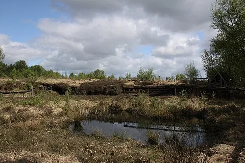 Moordorf Town, Südbrookmerland6.1 km E
-
Norden Town, Norden14 km NW
-
Landkreis Leer Municipality, Lower Saxony29 km S
-
Landkreis Wittmund Municipality, Lower Saxony27 km NE
-
Aurich Town, Aurich11 km E
-
Hage Town, Hage, Flecken12 km N
Sources & licences
Data last updated: