Langenhagen
Located in Region Hannover, Lower Saxony Coordinates: 52°27′02″ N 9°44′57″ E
- Population
- 54,142
- 54.1K
- Elevation
- 52 m
- above sea level
- Local time
- UTC+01:00
- Europe/Berlin · UTC+01:00
- Places inside
- 25
- listed under Langenhagen
About Langenhagen
Langenhagen is a village. Location: Region Hannover, Lower Saxony. Population: 54,142. Elevation: 52 m.
Langenhagen (German pronunciation: [laŋənˈhaːɡn̩] ; Eastphalian: Langenhogen) is a town in the Hanover district of Lower Saxony (Niedersachsen), Germany. Langenhagen is a small town of about fifty thousand people in Lower Saxony, Germany. The town is about 72 square kilometers and gets an average of 660 mm of rainfall a year. Langenhagen is Located about 8.3 km (5.3 miles) from Hanover and 248 km (154 miles) from Berlin.
Read more on Wikipedia Text: Wikipedia contributors · CC BY-SA 4.0 · shortened
At a glance
- Area
- 72 km²
Source: Wikidata
In comparison
- No. 3 of 21 places in Region Hannover by population
- Nearest larger town: Region Hannover, 1 km W
- 48 sights and natural places within 10 km Hannover-Langenhagen Concentration Camp, Hastrasee
- Listed here: Village: 15, Neighbourhood: 5, Lake: 2, Historic site: 1
Places in Langenhagen
25 places-
Langenhagen Town50.4K
-
Altenhorst Village
-
Brink Village
-
Engelbostel Village
-
Evershorst Village
-
Godshorn Village
-
Hainhaus Village
-
Hannover-Langenhagen Concentration Camp Historic site
-
Hastrasee Lake
-
Heideschlößchen Village
-
Kaltenweide Village
-
Krähenwinkel Village
-
Langenforth Village
-
Maspe Village
-
Naturschutzgebiet Kananohe Natural site
-
Rodenburg Village
-
Schulenburg Village
-
Schulenburger Mühle Neighbourhood
-
Schulenburg-Nord Village
-
Siedlung Twenge Neighbourhood
-
Silbersee Lake
-
Twenge Neighbourhood
-
Weiherfeld Neighbourhood
-
Wiesenau Neighbourhood
-
Wohldrift Village
Nearby attractions & nature
Everything nearby-
Große Heide Natural site, Hanover3.9 km SE
-
NDB-Funkfeuer HA Landmark, Isernhagen4.1 km E
-
Unterer Trentelgraben River, Lower Saxony3.8 km NE
-
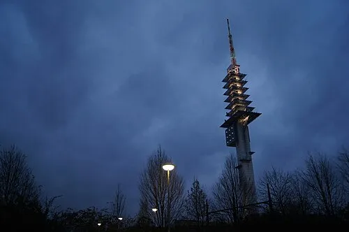 Telemax Landmark, Hanover7.3 km SE
-
Laher Graben River, Hanover4.4 km E
-
Mecklenheide Natural site, Hanover5.7 km SW
Sources & licences
Data last updated: · 2 independent sources