Oberer Mundatwald
Located in Germany Coordinates: 49°03′00″ N 7°54′00″ E
- Elevation
- 262 m
- above sea level
- Local time
- UTC+01:00
- Europe/Paris · UTC+01:00
About Oberer Mundatwald
Oberer Mundatwald is a natural site. Location: Germany.
In comparison
- 99 sights and natural places within 10 km Unterer Kirchberg, Großes Kesseltal
Nearest towns and villages
-
Wissembourg Village, Arrondissement of Haguenau3.6 km E
-
Sankt Germannshof Village, Bobenthal0.3 km S
-
Schweigen-Rechtenbach Village, Landkreis Südliche Weinstraße3.7 km E
-
Bobenthal Village, Südwestpfalz3.1 km NW
-
Rott Village, Arrondissement of Haguenau3 km S
-
Bobenthal Village, Bobenthal3.1 km NW
Nearby attractions & nature
Everything nearby-
Unterer Kirchberg Mountain, Bobenthal<0.1 km N
-
Großes Kesseltal Natural site, Rhineland-Palatinate<0.1 km N
-
Hoher Kopf Mountain, Bobenthal0.6 km N
-
Probstberg Mountain, Bobenthal1.3 km W
-
Oberer Kirchberg Mountain, Schweigen-Rechtenbach1.9 km N
-
Unterer Abtskopf Mountain, Rhineland-Palatinate1.9 km E
-
Oberer Abtskopf Mountain, Schweigen-Rechtenbach2.4 km E
-
Hoher Kopf Mountain, Schweigen-Rechtenbach2.4 km NE
More nature in Germany
-
Alschberg Mountain, Bobenthal2.5 km W
-
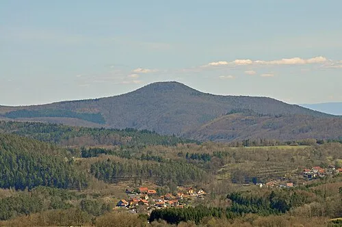 Bobenthaler Knopf Mountain, Bobenthal2.7 km NW
-
Hasenkopf Mountain, Bobenthal2.9 km W
-
Siebenteil Natural site, Rhineland-Palatinate2.9 km SW
-
Pitzberg Mountain, Schweigen-Rechtenbach3 km NE
-
Humberg Mountain, Schweigen-Rechtenbach3.1 km NE
Sources & licences
Data last updated: