Forst Osburg
Located in Rhineland-Palatinate, Germany Coordinates: 49°41′32″ N 6°50′20″ E
- Elevation
- 587 m
- above sea level
- Local time
- UTC+01:00
- Europe/Berlin · UTC+01:00
About Forst Osburg
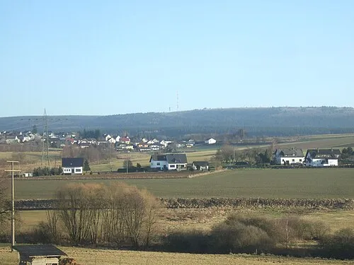
Forst Osburg is a natural site. Location: Rhineland-Palatinate, Germany.
In comparison
- 32 sights and natural places within 10 km Röster-Kopf, Hohe Wurzel
Airports nearest to Forst Osburg
- Frankfurt-Hahn Airport (HHN) Frankfurt am Main (Lautzenhausen) 42 km
- Luxembourg-Findel International Airport (LUX) Luxembourg 46 km
- Saarbrücken Airport (SCN) Saarbrücken 57 km
Straight-line distance; airports with scheduled flights only. Source: OurAirports (public domain).
Nearest towns and villages
-
Farschweiler Village, Landkreis Trier-Saarburg3.2 km N
-
Reinsfeld Village, Landkreis Trier-Saarburg3.4 km E
-
Reinsfeld Village, Reinsfeld3.3 km E
-
Farschweiler Village, Farschweiler3.2 km NW
-
Lorscheid Village, Landkreis Trier-Saarburg4.6 km N
-
Osburg Village, Landkreis Trier-Saarburg4.9 km NW
Nearby attractions & nature
Everything nearby-
Hohe Wurzel Mountain, Beuren (Hochwald)2.1 km NE
-
Röster-Kopf Mountain, Osburg1.9 km S
-
Osburger Hochwald Mountain, Rhineland-Palatinate2.4 km SW
-
Schleider Berg Mountain, Reinsfeld3.1 km SE
-
Röster-Kopf Mountain, Osburg4.1 km SW
-
Burgkopf Mountain, Lorscheid5.8 km N
-
Kupp Mountain, Beuren (Hochwald)5.3 km NE
-
Taubenberg Mountain, Reinsfeld5.4 km SE
More nature in Germany
-
Kesselberg Mountain, Hinzert-Pölert5.7 km E
-
Mühlenberg Mountain, Hermeskeil6.3 km SE
-
Pfaffenberg Mountain, Beuren (Hochwald)6.4 km NE
-
Hohenstein Mountain, Beuren (Hochwald)7.2 km NE
-
Nohberg Mountain, Beuren (Hochwald)7.5 km NE
-
 Teufelskopf Mountain, Waldweiler11 km S
Sources & licences
Data last updated: