Mühlbach
Located in Rhineland-Palatinate, Germany Coordinates: 49°04′12″ N 8°11′47″ E
- Elevation
- 117 m
- above sea level
- Local time
- UTC+01:00
- Europe/Berlin · UTC+01:00
About Mühlbach
Mühlbach is a river. Location: Rhineland-Palatinate, Germany.
In comparison
- 34 sights and natural places within 10 km Holderbühl, Dierbach
Nearest towns and villages
-
Kandel Village, Landkreis Germersheim2.1 km NW
-
Kandel Town, Kandel1.4 km N
-
Minfeld Village, Landkreis Germersheim3.7 km W
-
Minfeld Village, Minfeld3.7 km W
-
Wörth am Rhein Village, Landkreis Germersheim6 km SE
-
Erlenbach bei Kandel Village, Landkreis Germersheim4.6 km N
Nearby attractions & nature
Everything nearby-
Dierbach River, Rhineland-Palatinate3.6 km W
-
Holderbühl Mountain, Kandel3.2 km NE
-
Bienwald Natural site, Rhineland-Palatinate4 km SW
-
Oberer Buschur Natural site, Rhineland-Palatinate4.5 km NW
-
Bruchbach River, Rhineland-Palatinate4.6 km W
-
Galgenberg Mountain, Minfeld4 km NW
-
Wurmberg Mountain, Freckenfeld8.2 km W
-
Heßbach River, Rhineland-Palatinate7.9 km SE
More lakes, rivers and coasts in Germany
-
Heilbach River, Rhineland-Palatinate5.5 km SE
-
Wiebelsbach River, Rhineland-Palatinate6.1 km SE
-
Mittelbach River, Rhineland-Palatinate6.2 km W
-
Aschbach River, Rhineland-Palatinate6.4 km SW
-
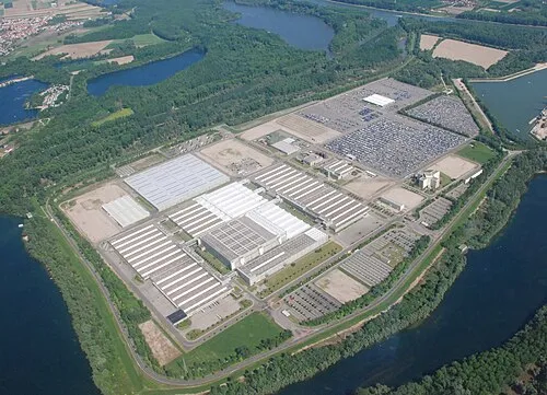 Insel Grün Island, Rhineland-Palatinate24 km NE
-
Quadbach River, Rhineland-Palatinate7.7 km N
Sources & licences
Data last updated: