Voreifel
Located in Rhineland-Palatinate, Germany Coordinates: 50°09′45″ N 7°05′45″ E
- Elevation
- 423 m
- above sea level
- Local time
- UTC+01:00
- Europe/Berlin · UTC+01:00
About Voreifel
Voreifel is a mountain. Location: Rhineland-Palatinate, Germany. Elevation: 423 m.
The Voreifel ("Fore-Eifel" or "Pre-Eifel") is the name of a settlement area in the southern part of the German state of North Rhine-Westphalia. It is a term that grew out of the local speech. The region of the Voreifel includes the towns and villages of Meckenheim, Rheinbach, Swisttal, the southern villages in Alfter, the western ones in Wachtberg and the northern villages of Grafschaft.
Read more on Wikipedia Text: Wikipedia contributors · CC BY-SA 4.0 · shortened
In comparison
- No. 12059 of 25787 mountains in Germany by elevation
- 35 sights and natural places within 10 km Cochemer Forst, Burglay
Nearest towns and villages
Nearby attractions & nature
Everything nearby-
Cochemer Forst Natural site, Rhineland-Palatinate2 km E
-
Burglay Mountain, Weiler3.3 km S
-
Klausberg Mountain, Gevenich3.7 km W
-
Speerberg Mountain, Dohr4.9 km S
-
Göftberg Mountain, Cochem5.1 km SE
-
Jünkernwald Natural site, Rhineland-Palatinate4.3 km E
-
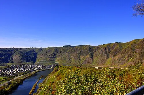 Calmont Mountain, Ediger-Eller6.3 km S
-
Staatsforst Cochem Natural site, Rhineland-Palatinate4.8 km S
Sources & licences
Data last updated: · 2 independent sources