Prümscheid
Located in Wallenborn, Vulkaneifel Coordinates: 50°10′05″ N 6°42′08″ E
- Elevation
- 675 m
- above sea level
- Local time
- UTC+01:00
- Europe/Berlin · UTC+01:00
About Prümscheid
Prümscheid is a mountain. Location: Wallenborn, Vulkaneifel. Elevation: 675 m.
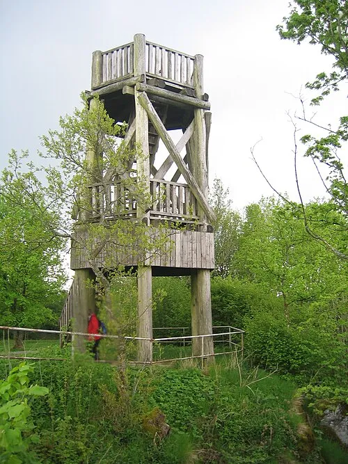
The Prümscheid is a mountain, 674.7 m above sea level (NHN), in the Eifel mountains in Germany. It is located near Wallenborn in the county of Vulkaneifel and is one of the highest peaks in the Eifel. Nearby villages are Salm, Büscheich and Wallenborn.
Read more on Wikipedia Text: Wikipedia contributors · CC BY-SA 4.0 · shortened
In comparison
- No. 3867 of 25787 mountains in Germany by elevation
- 97 sights and natural places within 10 km Kitzkorb, Nameless Point
Nearest towns and villages
-
Wallenborn Village, Wallenborn2.3 km SE
-
Salm Village, Salm1.9 km SW
-
Salm Village, Vulkaneifel2.4 km SW
-
Birresborn Village, Vulkaneifel5.2 km W
-
Weidenbach Village, Vulkaneifel4 km S
-
Niederstadtfeld Village, Niederstadtfeld4.2 km E
Nearby attractions & nature
Everything nearby-
Kitzkorb Natural site, Rhineland-Palatinate1.9 km N
-
Nameless Point Mountain, Wallenborn2.1 km N
-
Finsterheld Mountain, Gerolstein2.7 km W
-
Kretscheid Mountain, Weidenbach3 km SE
-
Forst Daun Natural site, Rhineland-Palatinate2.5 km W
-
Rödelkaul Mountain, Birresborn3.3 km W
-
 Dietzenley Mountain, Gerolstein4.2 km NW
-
Kirschkaul Mountain, Birresborn4.1 km W
Sources & licences
Data last updated: · 2 independent sources