Hedwigenkoog
Located in Kreis Dithmarschen, Schleswig-Holstein Coordinates: 54°11′00″ N 8°51′00″ E
- Population
- 209
- 209
- Elevation
- 0 m
- above sea level
- Local time
- UTC+01:00
- Europe/Berlin · UTC+01:00
- Places inside
- 6
- listed under Hedwigenkoog
About Hedwigenkoog
Hedwigenkoog is a village. Location: Kreis Dithmarschen, Schleswig-Holstein. Population: 209. Elevation: 0 m.
Hedwigenkoog (German pronunciation: [ˈheːtvɪɡn̩ˌkoːk], lit. 'Hedwig’s Koog') is a municipality belonging to the Amt ("collective municipality") Büsum-Wesselburen in the district Dithmarschen in Schleswig-Holstein, Germany. Hedwigenkoog is situated on the North Sea coast north of Büsum and Westerdeichstrich. It consists of 1600ha of marshland reclaimed from the sea (called a Koog in German) and protected with a dike in 1696 to secure the land connection between Büsum and Wesselburen.
Read more on Wikipedia Text: Wikipedia contributors · CC BY-SA 4.0 · shortened
At a glance
- Area
- 16.4 km²
Source: Wikidata
In comparison
- No. 90 of 116 places in Kreis Dithmarschen by population
- Nearest larger town: Hedwigenkoog, 0 km N
- 8 sights and natural places within 10 km Schwalkenstrom, Heringsander Strom
- Listed here: Village: 5, River: 1
Places in Hedwigenkoog
6 places-
Hedwigenkoog Village267
-
Hellschen Village
-
Heringsander Strom River
-
Purnurr Village
-
Unterschaar Village
-
Westerkoog Village
Nearby attractions & nature
Everything nearby-
Schwalkenstrom River, Süderdeich2.9 km NE
-
Wartstrom River, Oesterdeichstrich5.3 km SE
-
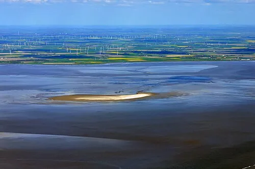 Blauort Island, Schleswig-Holstein7.6 km W
-
Leuchtturm Büsum Landmark, Büsum6.3 km S
-
Süder Balje River, Schleswig-Holstein6.8 km SE
-
Freizeitpark Natural site, Oesterwurth7.5 km E
Sources & licences
Data last updated: · 2 independent sources