Buchenwald concentration camp
Located in Weimar, Kreisfreie Stadt Weimar Coordinates: 51°01′21″ N 11°14′57″ E
- Local time
- UTC+01:00
- Europe/Berlin · UTC+01:00
- Elevation
- 432 m
- above sea level
About Buchenwald concentration camp
Buchenwald concentration camp is a historic site. Location: Weimar, Kreisfreie Stadt Weimar. Population: 48,000.
Buchenwald (German pronunciation: [ˈbuːxn̩valt]; 'beech forest') was a German Nazi concentration camp established on Ettersberg hill near Weimar, Germany, in July 1937. It was one of the first and the largest of the concentration camps within the Altreich (Old Reich) territories. Many actual or suspected communists were among the first internees.
Read more on Wikipedia Text: Wikipedia contributors · CC BY-SA 4.0 · shortened
At a glance
- Built
- 1937
Source: Wikidata
In comparison
- 44 sights and natural places within 10 km Buchenwald Concentration Camp, Großer Ettersberg
Nearby attractions & nature
Everything nearby-
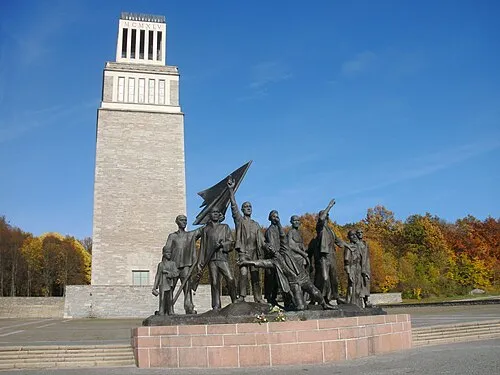 Buchenwald Concentration Camp Historic site, Weimar0.1 km S
-
Sender Weimar (Ettersberg) Landmark, Weimar1.2 km SE
-
Großer Ettersberg Mountain, Weimar1.1 km SE
-
Forst Ettersburg Natural site, Thuringia1.4 km SE
-
Giebelsberg Mountain, Am Ettersberg2.6 km NW
-
Berlstedt Concentration Camp Historic site, Am Ettersberg4.2 km N
-
Steinberg Mountain, Weimar4.2 km S
-
Wartenberg Mountain, Grammetal3.6 km SW
Nearest towns and villages
-
Ettersburg Village, Weimarer Land2.5 km NE
-
Hottelstedt Village, Am Ettersberg2.2 km NW
-
Ettersburg Village, Ettersburg2.5 km NE
-
Berlstedt Neighbourhood, Am Ettersberg4.3 km N
Sources & licences
Data last updated: · 2 independent sources