Hottelstedt
Located in Am Ettersberg, Weimarer Land Coordinates: 51°02′17″ N 11°13′44″ E
- Population
- 204
- 204
- Elevation
- 312 m
- above sea level
- Local time
- UTC+01:00
- Europe/Berlin · UTC+01:00
About Hottelstedt
Hottelstedt is a village. Location: Am Ettersberg, Weimarer Land. Population: 204. Elevation: 312 m.
Hottelstedt (German pronunciation: [ˈhɔtl̩ʃtɛt]) is a former municipality in the Weimarer Land district of Thuringia, Germany. Since 1 December 2007, it has been part of the municipality Berlstedt, which merged into the town Am Ettersberg on 1 January 2019.
Read more on Wikipedia Text: Wikipedia contributors · CC BY-SA 4.0 · shortened
At a glance
- Area
- 5.6 km²
Source: Wikidata
In comparison
- No. 13 of 13 places in Am Ettersberg by population
- Nearest larger town: Ballstedt, 2 km NW
- 46 sights and natural places within 10 km Giebelsberg, Buchenwald concentration camp
Nearby attractions & nature
Everything nearby-
Giebelsberg Mountain, Am Ettersberg1 km SW
-
Buchenwald concentration camp Historic site, Weimar2.2 km SE
-
Berlstedt Concentration Camp Historic site, Am Ettersberg2.8 km NE
-
Mönchsberg Mountain, Ollendorf2.4 km NW
-
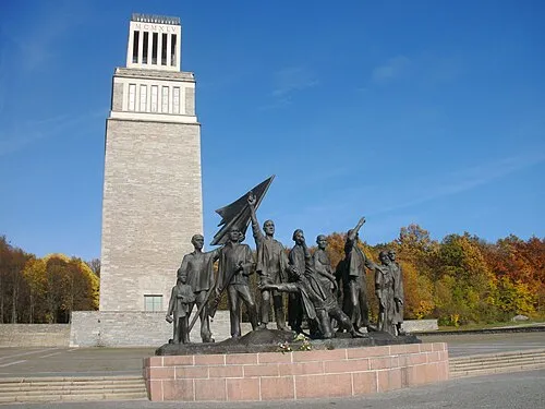 Buchenwald Concentration Camp Historic site, Weimar2.3 km SE
-
Wartenberg Mountain, Grammetal3.9 km SW
Sources & licences
Data last updated: · 2 independent sources