Schalkau
Located in Landkreis Sonneberg, Thuringia Coordinates: 50°24′00″ N 11°01′00″ E
- Population
- 3,111
- 3.1K
- Elevation
- 476 m
- above sea level
- Local time
- UTC+01:00
- Europe/Berlin · UTC+01:00
- Places inside
- 25
- listed under Schalkau
About Schalkau
Schalkau is a village. Location: Landkreis Sonneberg, Thuringia. Population: 3,111. Elevation: 476 m.
Schalkau (German pronunciation: [ˈʃalkaʊ] ) is a town in the district of Sonneberg, in Thuringia, Germany. It is situated 13 km west of Sonneberg, and 15 km north of Coburg. The former municipality Bachfeld was merged into Schalkau in December 2019.
Read more on Wikipedia Text: Wikipedia contributors · CC BY-SA 4.0 · shortened
At a glance
- Area
- 44 km²
Source: Wikidata
In comparison
- No. 7 of 8 places in Landkreis Sonneberg by population
- Nearest larger town: Schalkau, 1 km SW
- 99 sights and natural places within 10 km Galgenberg, Grümpentalbrücke
- Listed here: Village: 16, Mountain: 7, Historic site: 1, Landmark: 1
Places in Schalkau
25 places-
Schalkau Village3.4K
-
Bachfeld Village520
-
Almerswind Village
-
Burgruine Schaumburg Historic site
-
Ehnes Village
-
Emstadt Village
-
Galgenberg Mountain
-
Görsdorf Village
-
Gruber Höhe Mountain
-
Gundelswind Village
-
Katzberg Village
-
Kirchberg Mountain
-
Mausendorf Village
-
Neundorf Village
-
Oberroth Village
-
Roth Village
-
Schaumburg Mountain
-
Selsendorf Village
-
Steinauberg Mountain
-
Stiefvater Mountain
-
Talbrücke Truckenthal Landmark
-
Theuern Village
-
Truckendorf Village
-
Truckenthal Village
-
Weinberg Mountain
Nearby attractions & nature
Everything nearby-
Grümpentalbrücke Landmark, Frankenblick1.8 km SE
-
Kienberg Mountain, Frankenblick3 km E
-
Sonneberg-West Concentration Camp Historic site, Frankenblick2.8 km NE
-
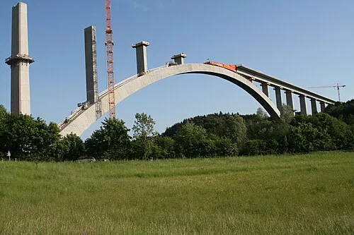 Talbrücke Froschgrundsee Landmark, Rödental5 km S
-
Burg Rauenstein Historic site, Frankenblick3.5 km NE
-
Steger Mountain, Neuhaus am Rennweg4.5 km N
Sources & licences
Data last updated: · 2 independent sources