Saalfeld/Saale
Located in Saalfeld-Rudolstadt, Thuringia Coordinates: 50°39′06″ N 11°22′35″ E
- Population
- 29,086
- 29.1K
- Elevation
- 213 m
- above sea level
- Local time
- UTC+01:00
- Europe/Berlin · UTC+01:00
- Places inside
- 67
- listed under Saalfeld/Saale
About Saalfeld/Saale
Saalfeld/Saale is a village. Location: Saalfeld-Rudolstadt, Thuringia. Population: 29,086. Elevation: 213 m.
In comparison
- Most populous of 26 places in Saalfeld-Rudolstadt
- Nearest larger town: Saalfeld-Rudolstadt, 7 km SW
- 82 sights and natural places within 10 km Saalfeld Stadtpfarrkirche, Mäuseberg
- Listed here: Village: 35, Mountain: 29, Attraction: 1, Landmark: 1
Places in Saalfeld/Saale
67 places-
Saalfeld Town28K
-
Schmiedefeld Village1.2K
-
Reichmannsdorf Village918
-
Remschütz Village
-
Arnsgereuth Village253
-
Wittgendorf Village216
-
Aue am Berg Village
-
Beerhügel Mountain
-
Bernsdorf Village
-
Beulwitz Village
-
Birkenheide Village
-
Blosberg Mountain
-
Braunsdorf Village
-
Burkersdorf Village
-
Crösten Village
-
Dittersdorf Village
-
Dittrichshütte Village
-
Eichkopf Mountain
-
Eyba Village
-
Garnsdorf Village
-
Gartenkuppe Mountain
-
Goldberg Mountain
-
Gorndorf Village
-
Gösselsberg Mountain
-
Gösselsdorf Village
-
Graba Village
-
Hasenhügel Mountain
-
Heiligenberg Mountain
-
Hinterer Breiter Berg Mountain
-
Hirschberg Mountain
-
Hochrück Mountain
-
Hoheneiche Village
-
Holzberg Mountain
-
Hufnagel Mountain
-
Hühnerschenke Village
-
Jehmichen Village
-
Kleingeschwenda Village
-
Knobelsdorf Village
-
Köditz Village
-
Lemnitzhügel Mountain
-
Lositz Village
-
Mäuseberg Mountain
-
Mühlberg Mountain
-
Obernitz Village
-
Pöllnitz Mountain
-
Rabenhügel Mountain
-
Rauhügel Mountain
-
Reschwitz Village
-
Ringberg Mountain
-
Rotschnabel Mountain
-
Saalfeld Stadtpfarrkirche Attraction
-
Schautalskopf Mountain
-
Schwarzer Berg Mountain
-
Schwarzer Berg Mountain
-
Sendeturm Schmiedefeld Landmark
-
Talberg Mountain
-
Talberg Mountain
-
Taubenbach Village
-
Töpfersbühl Mountain
-
Unterwirbach Village
Nearby attractions & nature
Everything nearby-
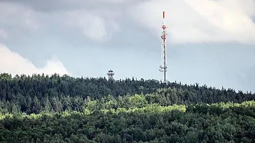 Kulm Mountain, Unterwellenborn3.6 km N
-
Lohberg Mountain, Unterwellenborn3.5 km NE
-
Dudelteich Lake, Thuringia2.5 km NW
-
Lositz Mountain, Rudolstadt4 km NW
-
Roter Berg Mountain, Kaulsdorf3.5 km SE
-
Pfaffenberg Mountain, Unterwellenborn4.4 km NE
Sources & licences
Data last updated: