- Population
- 83
- 83
- Elevation
- 81 m
- above sea level
- Local time
- UTC+02:00
- Europe/Athens · UTC+02:00
- Airports
- CFU Corfu Ioannis Kapodistrias International Airport10 km
- IOA Ioannina King Pyrrhus National Airport88 km
About Kokkinogeia
Kokkinogeia is a village. Location: Corfu, Nomós Kerkýras. Population: 83. Elevation: 81 m. The best months to visit are May. The nearest airport is Corfu Ioannis Kapodistrias International Airport (10 km).
Photos of Kokkinogeia
-
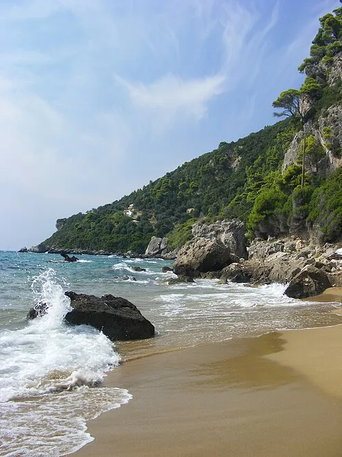
Myrtiotissa maczopikczu · CC BY 3.0

Climate of Kokkinogeia
Best months for sightseeingBest months for sightseeing: May.
This month · November
A wet month
Day 18° · Night 9° · Rain 183 mm
- Hottest month
- August (day 31°)
- Coldest month
- January (night 4°)
- Wettest month
- November (183 mm)
- Driest month
- July (11 mm)
Bars: average monthly low and high temperature. Below: precipitation. Monthly averages for 1970–2000 at about 18 km resolution, adjusted for elevation. Highlighted months are mild and relatively dry. Source: WorldClim 2.1 (CC BY 4.0).
Show values as a table
| Month | Jan | Feb | Mar | Apr | May | Jun | Jul | Aug | Sep | Oct | Nov | Dec |
|---|---|---|---|---|---|---|---|---|---|---|---|---|
| Average high (°C) | 13° | 14° | 15° | 19° | 23° | 28° | 31° | 31° | 27° | 23° | 18° | 15° |
| Average low (°C) | 4° | 5° | 6° | 9° | 13° | 17° | 19° | 19° | 16° | 12° | 9° | 6° |
| Precipitation (mm) | 123 | 125 | 99 | 67 | 38 | 14 | 11 | 23 | 68 | 142 | 183 | 167 |
Other places to visit in this season: May
How to get to Kokkinogeia
The nearest airport is Corfu Ioannis Kapodistrias International Airport (CFU), 10 km to the east as the crow flies. The nearest large city is Piraeus, 382 km to the southeast.
Airports
- Corfu Ioannis Kapodistrias International Airport (CFU) Kerkyra (Corfu) 10 kmeast
- Ioannina King Pyrrhus National Airport (IOA) Ioannina 88 kmeast
- Aktion National Airport (PVK) Preveza 112 kmsoutheast
Nearby large cities
- Piraeus Population: 163.7K 382 kmsoutheast
- Athens Population: 664K 386 kmsoutheast
Straight-line distances; road distances are longer. Airport data: OurAirports.
Day trips from Kokkinogeia
Within 100 km: 5 historic and cultural sites, 10 lakes, rivers and coasts.
0–25 km7 places
- Paramonas Beach Beach 11 kmS
- Kanouli Beach 16 kmS
- Myrtiotissa Beach 1 kmS
- Maitland Monument Landmark 11 kmE
25–60 km5 places
- Orthólithos Island 55 kmSE
- Kaltsonísi Island 59 kmSE
- Nisída Xolítharo Island 49 kmSE
- Nisída Ágios Nikólaos Island 56 kmSE
60–100 km3 places
- Moni pantanassas Attraction 87 kmE
- Stoupaina Monastery Attraction 87 kmE
- Panagia Island 63 kmSE
Straight-line distances.
Other cities and towns in Corfu
-
Varypatades Village, Corfu4.7 km SE
-
Afra Village, Corfu5.4 km E
-
 Gouvia Village, Corfu6.5 km NE
-
Evropouloi Village, Corfu6.1 km E
-
Kourkoulaiika Village, Corfu4.5 km NE
-
Giannades Village, Corfu4.3 km NW
Sources & licences
Data last updated: