- Population
- 108,652
- 108.7K
- Elevation
- 65 m
- above sea level
- Local time
- UTC+02:00
- Europe/Athens · UTC+02:00
- Places inside
- 275
- listed under Corfu
- Airports
- CFU Corfu Ioannis Kapodistrias International Airport8 km
- IOA Ioannina King Pyrrhus National Airport85 km
About Corfu
Corfu is a municipality. Location: Nomós Kerkýras, Ionian Islands. Population: 108,652. Elevation: 65 m. The best months to visit are May, October. The nearest airport is Corfu Ioannis Kapodistrias International Airport (8 km). Nearby sights include Myrtiotissa and Límni Koríssia.
Photos of Corfu
-
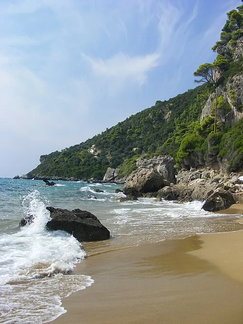
Myrtiotissa maczopikczu · CC BY 3.0 -
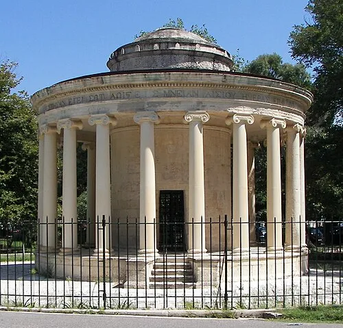
Maitland Monument No machine-readable author provided. Tasoskessaris assumed · CC BY-SA 4.0 -
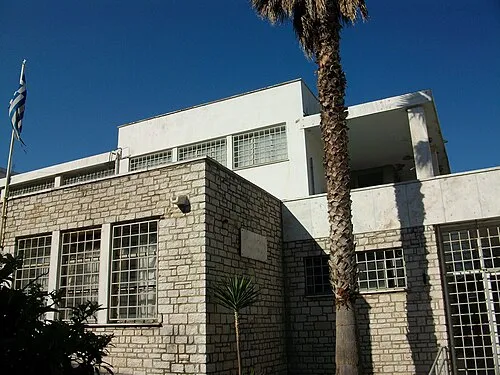
Archaeological Museum of Corfu Joanbanjo · CC BY-SA 3.0


Climate of Corfu
Best months for sightseeingBest months for sightseeing: May, October.
This month · November
A wet month
Day 18° · Night 9° · Rain 179 mm
- Hottest month
- August (day 31°)
- Coldest month
- January (night 5°)
- Wettest month
- November (179 mm)
- Driest month
- July (11 mm)
Bars: average monthly low and high temperature. Below: precipitation. Monthly averages for 1970–2000 at about 18 km resolution, adjusted for elevation. Highlighted months are mild and relatively dry. Source: WorldClim 2.1 (CC BY 4.0).
Show values as a table
| Month | Jan | Feb | Mar | Apr | May | Jun | Jul | Aug | Sep | Oct | Nov | Dec |
|---|---|---|---|---|---|---|---|---|---|---|---|---|
| Average high (°C) | 13° | 14° | 16° | 19° | 24° | 28° | 31° | 31° | 27° | 23° | 18° | 15° |
| Average low (°C) | 5° | 5° | 7° | 10° | 14° | 17° | 19° | 19° | 16° | 13° | 9° | 6° |
| Precipitation (mm) | 118 | 124 | 97 | 66 | 37 | 14 | 11 | 23 | 68 | 137 | 179 | 164 |
How to get to Corfu
The nearest airport is Corfu Ioannis Kapodistrias International Airport (CFU), 8 km to the southeast as the crow flies. The nearest large city is Piraeus, 381 km to the southeast.
Airports
- Corfu Ioannis Kapodistrias International Airport (CFU) Kerkyra (Corfu) 8 kmsoutheast
- Ioannina King Pyrrhus National Airport (IOA) Ioannina 85 kmeast
- Aktion National Airport (PVK) Preveza 113 kmsoutheast
Nearby large cities
- Piraeus Population: 163.7K 381 kmsoutheast
- Athens Population: 664K 385 kmsoutheast
Straight-line distances; road distances are longer. Airport data: OurAirports.
Day trips from Corfu
Within 100 km: 5 historic and cultural sites, 10 lakes, rivers and coasts.
0–25 km7 places
- Paramonas Beach Beach 15 kmS
- Límni Koríssia Lake 23 kmS
- Myrtiotissa Beach 6 kmSW
- Maitland Monument Landmark 8 kmE
25–60 km4 places
- Orthólithos Island 56 kmSE
- Nisída Xolítharo Island 51 kmSE
- Nisída Ágios Nikólaos Island 58 kmSE
- Límni Cháskova Lake 57 kmE
60–100 km4 places
- Kaltsonísi Island 61 kmSE
- Panagia Island 63 kmSE
- Moni pantanassas Attraction 83 kmE
- Stoupaina Monastery Attraction 83 kmE
Straight-line distances.
Corfu and similar cities
Side by side with cities of similar size in the same country: population, elevation and climate.
| Measure | Corfu | Piraeus |
|---|---|---|
| Population | 108.7K | 163.7K |
| Elevation | 65 m | 29 m |
| Summer day (hottest month) | 31° | 32° |
| Winter night (coldest month) | 5° | 7° |
| Annual rainfall | 1,038 mm | 422 mm |
| Best months | May, Oct | Apr–May, Oct |
| Distance | — | 381 km |
Climate values are 1970–2000 monthly averages; straight-line distance.
Places in Corfu
275 places- 241 Apolysoi 21
- 242 Skala 21
- 243 Troumpettas 20
- 244 Kelliá 20
- 245 Vasilika Peritheias 20
- 246 Kavalleraina 19
- 247 Vrachleri 19
- 248 Katavolos 19
- 249 Trimodi 17
- 250 Vathí 17
- 251 Krinias 16
- 252 Kokkokylas 14
- 253 Plagia 14
- 254 Pigi 13
- 255 Karniaris 12
- 256 Pilida 12
- 257 Lithiasménos 11
- 258 Glyfada 10
- 259 Kardamatika 9
- 260 Episkopi 8
- 261 Rafaládes 8
- 262 Mengoulas 6
- 263 Apraos 5
- 264 Rou 5
- 265 Avramis 4
- 266 Afionitika 3
- 267 Peritheia 3
- 268 Fourní 2
- 269 Agios Georgios Kassiopis 1
Bar: population relative to the most populous place in this list.
Cities & villages2
- Podolakkos · Village
- Bastátika · Neighbourhood
Lakes, rivers & coasts1
- Paramonas Beach · Beach
Heritage & sights3
- Archaeological Museum of Corfu · Museum
- Ionios Vouli · Museum
- Maitland Monument · Landmark
Nearby attractions & nature
Everything nearby-
Myrtiotissa Beach, Ionian Islands6 km SW
-
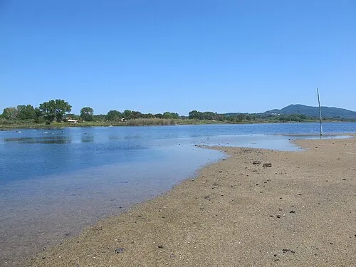 Límni Koríssia Lake, Nomós Kerkýras23 km S
-
Kanouli Beach, Nomós Kerkýras19 km S
Other cities and towns in Nomós Kerkýras
Sources & licences
Data last updated: