- Population
- 96,889
- 96.9K
- Elevation
- 271 m
- above sea level
- Local time
- UTC+02:00
- Europe/Athens · UTC+02:00
- Places inside
- 165
- listed under Agrinio
- Airports
- GPA Patras Araxos Agamemnon Airport56 km
- PVK Aktion National Airport67 km
About Agrinio
Agrinio is a municipality. Location: Aitoloakarnania, West Greece. Population: 96,889. Elevation: 271 m. The best months to visit are May, October. The nearest airport is Patras Araxos Agamemnon Airport (56 km).
Climate of Agrinio
Best months for sightseeingBest months for sightseeing: May, October.
This month · November
A wet month
Day 17° · Night 7° · Rain 147 mm
- Hottest month
- July (day 31°)
- Coldest month
- January (night 3°)
- Wettest month
- November (147 mm)
- Driest month
- July (13 mm)
Bars: average monthly low and high temperature. Below: precipitation. Monthly averages for 1970–2000 at about 18 km resolution, adjusted for elevation. Highlighted months are mild and relatively dry. Source: WorldClim 2.1 (CC BY 4.0).
Show values as a table
| Month | Jan | Feb | Mar | Apr | May | Jun | Jul | Aug | Sep | Oct | Nov | Dec |
|---|---|---|---|---|---|---|---|---|---|---|---|---|
| Average high (°C) | 12° | 12° | 15° | 18° | 23° | 28° | 31° | 31° | 28° | 22° | 17° | 13° |
| Average low (°C) | 3° | 3° | 5° | 7° | 11° | 15° | 17° | 17° | 14° | 11° | 7° | 4° |
| Precipitation (mm) | 94 | 106 | 76 | 61 | 35 | 17 | 13 | 15 | 38 | 93 | 147 | 128 |
How to get to Agrinio
The nearest airport is Patras Araxos Agamemnon Airport (GPA), 56 km to the south as the crow flies. For international flights: Kefalonia International Airport "Anna Pollatou" (EFL) (102 km). The nearest large city is Piraeus, 207 km to the east.
Airports
- Patras Araxos Agamemnon Airport (GPA) Patras 56 kmsouth
- Aktion National Airport (PVK) Preveza 67 kmnorthwest
- Kefalonia International Airport "Anna Pollatou" (EFL) Kefallinia Island 102 kmsouthwest
Nearby large cities
- Piraeus Population: 163.7K 207 kmeast
- Athens Population: 664K 212 kmeast
Straight-line distances; road distances are longer. Airport data: OurAirports.
Day trips from Agrinio
Within 100 km: 18 historic and cultural sites, 1 natural site, 24 lakes, rivers and coasts.
25–60 km23 places
- Moni Tatárnas Attraction 33 kmN
- Moni Retha Attraction 48 kmNW
- Kablafka Beach 40 kmW
- Nisída Sáranta Island 35 kmS
60–100 km20 places
- Kefalonia Island 88 kmSW
- Moní Genesíou Theotókou Damástas Attraction 90 kmE
- Moní Antinítsis Attraction 91 kmNE
- Moni Spilias Attraction 68 kmN
Straight-line distances.
Agrinio and similar cities
Side by side with cities of similar size in the same country: population, elevation and climate.
| Measure | Agrinio | Piraeus |
|---|---|---|
| Population | 96.9K | 163.7K |
| Elevation | 271 m | 29 m |
| Summer day (hottest month) | 31° | 32° |
| Winter night (coldest month) | 3° | 7° |
| Annual rainfall | 823 mm | 422 mm |
| Best months | May, Oct | Apr–May, Oct |
| Distance | — | 207 km |
Climate values are 1970–2000 monthly averages; straight-line distance.
Places in Agrinio
165 places- 121 Agios Ioannis Peristeriou 27
- 122 Afrato 26
- 123 Loustra 26
- 124 Makra Logka 26
- 125 Strongylaiika 26
- 126 Agia Triada Gounari 24
- 127 Kato Agios Vlasios 24
- 128 Palaiokaria 23
- 129 Skalitina 23
- 130 Kamaretsaiika 22
- 131 Potamoula Mesolοngiou 22
- 132 Schinos 22
- 133 Kato Lampiri 21
- 134 Loleika 21
- 135 Skiadaiika 21
- 136 Stekoula 21
- 137 Varkoulia 21
- 138 Saranti 20
- 139 Mpasdounaiika 19
- 140 Palaiochoria 18
- 141 Strigania 18
- 142 Ano Metapa 17
- 143 Kampos 17
- 144 Alonia 16
- 145 Platanos Ampelion 16
- 146 Agios Georgios Kleisorrevmaton 15
- 147 Stavros 15
- 148 Tsiligiannaiika 15
- 149 Agia Deftera 13
- 150 Drosiniatika 13
- 151 Lakomata 13
- 152 Laspes 12
- 153 Prosilia 11
- 154 Charama 9
- 155 Krapsi 8
- 156 Andronaiika 7
- 157 Lapato 7
- 158 Lentini 7
- 159 Rio 6
- 160 Agia Paraskevi Pentakorfou 5
- 161 Mavromiti 5
- 162 Kato Kampos 4
- 163 Klima 3
- 164 Palaiochori 3
- 165 Paliozevgaro 1
Bar: population relative to the most populous place in this list.
Other cities and towns in Aitoloakarnania
-
Agrinio Town, Agrinio5.4 km SW
-
Agios Konstantinos Town, Agrinio5.3 km SW
-
Missolonghi Municipality, Aitoloakarnania28 km SW
-
Xiromero Municipality, Aitoloakarnania30 km W
-
Nafpaktia Municipality, Aitoloakarnania35 km SE
-
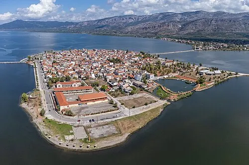 Aitoliko Town, Missolonghi26 km S
Sources & licences
Data last updated: