Mátraverebély
Located in Nógrád megye, Hungary Coordinates: 47°58′27″ N 19°46′50″ E
- Population
- 2,197
- 2.2K
- Elevation
- 178 m
- above sea level
- Local time
- UTC+01:00
- Europe/Budapest · UTC+01:00
About Mátraverebély
Mátraverebély is a village. Location: Nógrád megye, Hungary. Population: 2,197. Elevation: 178 m.
Mátraverebély is a village in Nógrád County, Hungary, beside the Zagyva river, between the Cserhát and Mátra mountain ranges. As of 2022 census, it has a population of 1752 (see Demographics). The main road 21 goes across the village, which located beside of the (Nr. 81) Hatvan–Fiľakovo railway line and 38.4 km away from the M3 motorway. The village has its own railway stop with public transport.
Read more on Wikipedia Text: Wikipedia contributors · CC BY-SA 4.0 · shortened
At a glance
- Area
- 18.4 km²
Source: Wikidata
In comparison
- No. 15 of 126 places in Nógrád megye by population
- Nearest larger town: Bátonyterenye, 5 km E
- 4 sights and natural places within 10 km Kisterenye Ghetto, Nyikom
Nearby attractions & nature
Everything nearby-
Kisterenye Ghetto Historic site, Nógrád megye6.2 km NE
-
Hármashatár-hegy Mountain, Nógrád megye8.7 km W
-
Lajszka Mountain, Nógrád megye11 km E
-
Nyikom Mountain, Hungary7.6 km S
-
Muzsla Mountain, Hungary9.8 km S
-
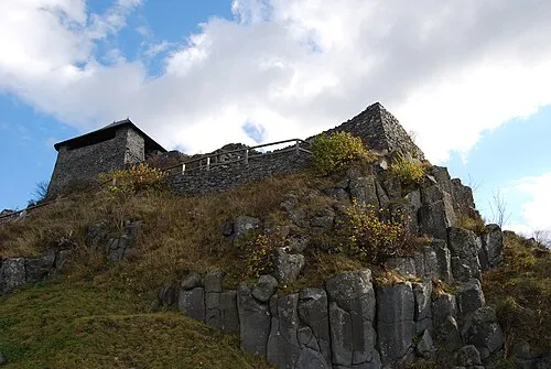 Salgó Mountain, Nógrád megye20 km N
Sources & licences
Data last updated: · 2 independent sources