Truskmore
Local name: Trosc Mór
Located in County Sligo, Connacht Coordinates: 54°22′27″ N 8°22′18″ W

- Elevation
- 647 m
- above sea level
- Local time
- UTC+00:00
- Europe/Dublin · UTC+00:00
- Airports
- NOC Ireland West Airport Knock59 km
- CFN Donegal Airport75 km
About Truskmore
Truskmore is a mountain. Location: County Sligo, Connacht. Elevation: 647 m.
Truskmore (Irish: Trosc Mór, meaning 'big cod') is a mountain with a height of 647 metres (2,123 ft) on the border of County Sligo and County Leitrim in Ireland. It is the highest summit in the Dartry Mountains and the highest in Sligo. It is in the middle of a plateau whose edges are marked by high cliffs, including Benbulbin (526m), Benwiskin (514m), Slievemore (597m) and Kings Mountain (462m).
Read more on Wikipedia Text: Wikipedia contributors · CC BY-SA 4.0 · shortened
At a glance
- Topographic prominence
- 560 m
Source: Wikidata
In comparison
- No. 182 of 2106 mountains in Ireland by elevation
- 37 sights and natural places within 10 km Truskmore transmitter, Truskmore E cairn
Climate of Truskmore
Bars: average monthly low and high temperature. Below: precipitation. Monthly averages for 1970–2000 at about 18 km resolution, adjusted for elevation. Highlighted months are mild and relatively dry. Source: WorldClim 2.1 (CC BY 4.0).
Show values as a table
| Month | Jan | Feb | Mar | Apr | May | Jun | Jul | Aug | Sep | Oct | Nov | Dec |
|---|---|---|---|---|---|---|---|---|---|---|---|---|
| Average high (°C) | 4° | 4° | 6° | 8° | 11° | 13° | 14° | 14° | 12° | 9° | 6° | 5° |
| Average low (°C) | -1° | -1° | 0° | 1° | 3° | 6° | 8° | 8° | 6° | 4° | 1° | 0° |
| Precipitation (mm) | 176 | 124 | 141 | 90 | 93 | 94 | 102 | 122 | 140 | 172 | 175 | 178 |
Airports nearest to Truskmore
- Ireland West Airport Knock (NOC) Charlestown 59 km
- Donegal Airport (CFN) Donegal 75 km
- City of Derry Airport (LDY) Derry, Derry and Strabane 108 km
Straight-line distance; airports with scheduled flights only. Source: OurAirports (public domain).
Nearest towns and villages
-
Balinlig Village, County Leitrim2.9 km E
-
Ballaghnatrillick Bridge Village, County Sligo3.9 km NW
-
Cloontyprughlish Village, County Leitrim3.4 km E
-
Cliffony Village, County Sligo8.5 km NW
-
Ballaghnatrillick Village, County Sligo4.9 km N
-
Largydonnell Village, County Leitrim5.3 km NE
Nearby attractions & nature
Everything nearby-
Truskmore E cairn Mountain, County Sligo0.5 km SE
-
Truskmore transmitter Landmark, County Sligo0.1 km S
-
Taobh Ban Mountain, County Leitrim2.7 km N
-
Annacoona Top Mountain, County Sligo3.3 km W
-
Tormore Mountain, County Sligo3.3 km SW
-
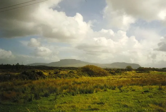 Dartry Mountains Mountain, County Sligo5.4 km SW
-
Benwiskin Mountain, County Sligo4 km NW
-
Diffreen River River, County Leitrim4 km S
Sources & licences
Data last updated: · 2 independent sources