- Elevation
- 31 m
- above sea level
- Local time
- UTC+00:00
- Europe/Dublin · UTC+00:00
- Airports
- NOC Ireland West Airport Knock54 km
- CFN Donegal Airport79 km
About Dartry Mountains
Dartry Mountains is a mountain. Location: County Sligo, Connacht. Elevation: 31 m.
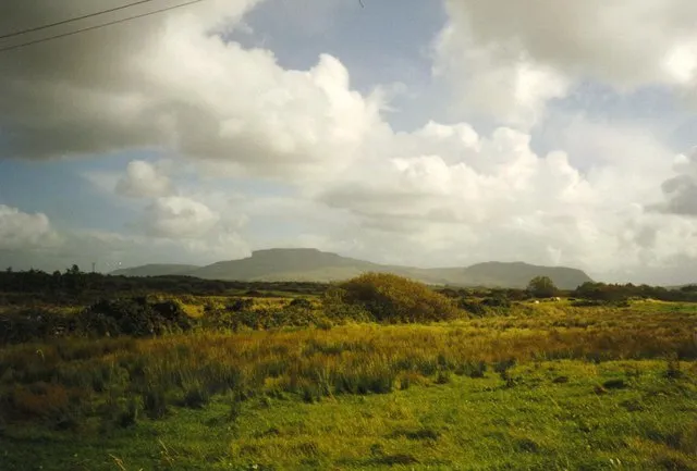
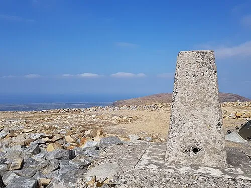
The Dartry Mountains (Irish: Sléibhte Dhartraí) are a mountain range in the north west of Ireland, in the north of counties Sligo and Leitrim. They lie between Lough Melvin, Lough Gill and Lough MacNean. The highest point is Truskmore at 647 metres (2,123 ft). Other notable mountains include Benbulbin at 526 metres (1,726 ft), Benwiskin at 514 metres (1,686 ft), and Tievebaun at 611 metres (2,005 ft). The mountains are named after the old túath of Dartraighe, which was part of the kingdom of Bréifne.
Source: Wikipedia · CC BY-SA 4.0
Photos of Dartry Mountains
-

Dieglop · CC BY-SA 4.0 -

Sherofeternia · CC BY-SA 4.0 -

Subhrambar · CC BY-SA 4.0 -

NTF30 · CC BY-SA 4.0 -

Dieglop · CC BY-SA 4.0


Climate of Dartry Mountains
Best months for sightseeingBest months for sightseeing: June–August.
This month · November
A wet month
Day 10° · Night 5° · Rain 155 mm
- Hottest month
- July (day 19°)
- Coldest month
- January (night 2°)
- Wettest month
- January (156 mm)
- Driest month
- April (80 mm)
Bars: average monthly low and high temperature. Below: precipitation. Monthly averages for 1970–2000 at about 18 km resolution, adjusted for elevation. Highlighted months are mild and relatively dry. Source: WorldClim 2.1 (CC BY 4.0).
Show values as a table
| Month | Jan | Feb | Mar | Apr | May | Jun | Jul | Aug | Sep | Oct | Nov | Dec |
|---|---|---|---|---|---|---|---|---|---|---|---|---|
| Average high (°C) | 8° | 8° | 10° | 12° | 15° | 17° | 19° | 18° | 16° | 13° | 10° | 9° |
| Average low (°C) | 2° | 3° | 4° | 5° | 7° | 10° | 12° | 12° | 10° | 7° | 5° | 4° |
| Precipitation (mm) | 156 | 109 | 127 | 80 | 82 | 85 | 91 | 112 | 126 | 152 | 155 | 156 |
How to get to Dartry Mountains
The nearest airport is Ireland West Airport Knock (NOC), 54 km to the southwest as the crow flies. The nearest large city is Belfast, 164 km to the east.
Airports
- Ireland West Airport Knock (NOC) Charlestown 54 kmsouthwest
- Donegal Airport (CFN) Donegal 79 kmnorth
- City of Derry Airport (LDY) Derry, Derry and Strabane 113 kmnortheast
Nearby large cities
- Belfast Population: 348K 164 kmeast
- Dublin Population: 1M 181 kmsoutheast
- Limerick Population: 102.3K 186 kmsouth
- Cork Population: 224K 271 kmsouth
- Glasgow Population: 626.4K 315 kmnortheast
Straight-line distances; road distances are longer. Airport data: OurAirports.
Day trips from Dartry Mountains
Within 100 km: 181 historic and cultural sites, 661 natural sites, 1,390 lakes, rivers and coasts.
0–25 km217 places
- Strandhill Beach Beach 14 kmSW
- Dunmoran Strand Beach 22 kmW
- Inishmurray Island 19 kmNW
- Coney Island Island 12 kmW
25–60 km806 places
- Inishteige Island 29 kmE
- Station Island Island 47 kmNE
- Rathlin O’Birne Island Island 45 kmNW
- Gull Island Island 51 kmN
60–100 km1,209 places
- Inishlyre Island 99 kmSW
- Umfin Island Island 86 kmN
- Rutland Island Island 72 kmN
- Pig Island Island 85 kmW
Straight-line distances.
Nearest towns and villages
Nearby attractions & nature
Everything nearby-
Copes Mountain Mountain, County Sligo2 km SE
-
Tormore Mountain, County Sligo2.2 km N
-
Kings Mountain Mountain, County Sligo2.9 km NW
-
Crockauns Mountain, County Leitrim3.5 km SE
-
Glencar Lough Lake, Ireland2.1 km NE
-
 Truskmore Mountain, County Sligo5.4 km NE
-
Annacoona Top Mountain, County Sligo3.5 km N
-
Benbulbin South East Top Mountain, County Sligo3.9 km NW
More nature in Ireland
-
Keelogyboy Mountain Mountain, County Sligo5.6 km SE
-
Benbulbin Mountain, County Sligo5.1 km NW
-
 Knocknarea Mountain, County Sligo13 km SW
-
Truskmore E cairn Mountain, County Sligo5.4 km NE
-
Keelogyboy Mtn SW Top Mountain, County Sligo5.6 km SE
-
Benwiskin Mountain, County Sligo6.3 km N
Sources & licences
Data last updated: · 2 independent sources