Donacarney
Located in County Meath, Leinster Coordinates: 53°42′48″ N 6°16′45″ W
- Elevation
- 23 m
- above sea level
- Local time
- UTC+00:00
- Europe/Dublin · UTC+00:00
About Donacarney
Donacarney is a village. Location: County Meath, Leinster. Elevation: 23 m.
Donacarney (Irish: Domhnach Cearnaigh or Domhnach Cairnigh) is a village in County Meath, Ireland, close to Drogheda and the border with County Louth. It contains one church, two estates, two schools, and one pub. Although it includes the townlands of Donacarney Great and Donacarney Little, most locals would never use those terms in describing Donacarney. The remains of a late-medieval tower house (see picture to right) are sited close to Donacarney Cross.
Read more on Wikipedia Text: Wikipedia contributors · CC BY-SA 4.0 · shortened
At a glance
- Area
- 2.2 km²
Source: Wikidata
In comparison
- Nearest larger town: Beaulieu House, 3 km NW
- 9 sights and natural places within 10 km River Boyne, Boyne Viaduct
Nearby attractions & nature
Everything nearby-
River Boyne River, County Meath2.4 km NE
-
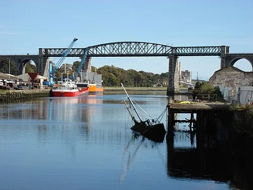 Boyne Viaduct Landmark, County Louth3.9 km W
-
Benhead Natural site, County Meath7.4 km SE
-
Dardistown Castle Historic site, County Meath5.7 km SW
-
 Hunky Dorys Park Landmark, County Louth5.3 km W
-
River Nanny River, County Meath6 km SE
Sources & licences
Data last updated: · 2 independent sources