Ballinroad
Located in County Wexford, Leinster Coordinates: 52°31′04″ N 6°24′22″ W
- Population
- 1,161
- 1.2K
- Elevation
- 130 m
- above sea level
- Local time
- UTC+00:00
- Europe/Dublin · UTC+00:00
About Ballinroad
Ballinroad is a village. Location: County Wexford, Leinster. Population: 1,161. Elevation: 130 m.
Ballinroad (Irish: Baile an Rodaigh, meaning 'Town of the Rodaigh' also listed as Baile an Róid "Homestead of the Road ) is a village approximately 3 km from Dungarvan, County Waterford on the south coast of Ireland. Ballinroad grew rapidly during the Celtic tiger era and is one of Dungarvan's main residential areas.
Read more on Wikipedia Text: Wikipedia contributors · CC BY-SA 4.0 · shortened
In comparison
- No. 11 of 48 places in County Wexford by population
- Nearest larger town: Ferns, 10 km NW
- 10 sights and natural places within 10 km Oulart Hill, Slievenagorra Hill
Nearby attractions & nature
Everything nearby-
Oulart Hill Mountain, County Wexford0.4 km SE
-
Slievenagorra Hill Mountain, County Wexford3.5 km S
-
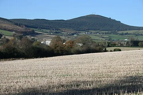 Slieveboy Mountain, County Wexford16 km N
-
Ballynamona Hill Mountain, County Wexford7.2 km SE
-
Aughanall River River, County Wexford7.5 km SE
-
Castle Talbot Historic site, County Wexford8.1 km SE
Sources & licences
Data last updated: · 2 independent sources