- Elevation
- 125 m
- above sea level
- Local time
- UTC+00:00
- Europe/Dublin · UTC+00:00
- Airports
- DUB Dublin Airport105 km
- ORK Cork International Airport159 km
About Slievenagorra Hill
Slievenagorra Hill is a mountain. Location: County Wexford, Leinster. Elevation: 125 m. The best months to visit are June–September. The nearest airport is Dublin Airport (105 km). Nearby sights include Oulart Hill and Ballynamona Hill.
Climate of Slievenagorra Hill
Best months for sightseeingBest months for sightseeing: June–September.
This month · November
A cold month
Day 10° · Night 5° · Rain 98 mm
- Hottest month
- August (day 18°)
- Coldest month
- February (night 3°)
- Wettest month
- January (114 mm)
- Driest month
- June (57 mm)
Bars: average monthly low and high temperature. Below: precipitation. Monthly averages for 1970–2000 at about 18 km resolution, adjusted for elevation. Highlighted months are mild and relatively dry. Source: WorldClim 2.1 (CC BY 4.0).
Show values as a table
| Month | Jan | Feb | Mar | Apr | May | Jun | Jul | Aug | Sep | Oct | Nov | Dec |
|---|---|---|---|---|---|---|---|---|---|---|---|---|
| Average high (°C) | 8° | 8° | 9° | 11° | 13° | 16° | 18° | 18° | 16° | 13° | 10° | 9° |
| Average low (°C) | 3° | 3° | 4° | 5° | 7° | 10° | 12° | 12° | 10° | 8° | 5° | 4° |
| Precipitation (mm) | 114 | 88 | 81 | 60 | 65 | 57 | 58 | 78 | 86 | 103 | 98 | 111 |
Other places to visit in this season: June July August September
How to get to Slievenagorra Hill
The nearest airport is Dublin Airport (DUB), 105 km to the north as the crow flies. The nearest large city is Dublin, 95 km to the north.
Airports
- Dublin Airport (DUB) Dublin 105 kmnorth
- Cork International Airport (ORK) Cork 159 kmsouthwest
- Shannon Airport (SNN) Shannon 171 kmwest
Nearby large cities
- Dublin Population: 1M 95 kmnorth
- Limerick Population: 102.3K 151 kmwest
- Cork Population: 224K 155 kmsouthwest
- Swansea Population: 300.4K 195 kmsoutheast
- Belfast Population: 348K 237 kmnorth
Straight-line distances; road distances are longer. Airport data: OurAirports.
Day trips from Slievenagorra Hill
Within 100 km: 221 historic and cultural sites, 488 natural sites, 237 lakes, rivers and coasts.
0–25 km62 places
- Curracloe Beach Beach 12 kmS
- Kings Island Island 11 kmSW
- Doo Lough Lake 10 kmSE
- Vinegar Hill Mountain 9 kmW
25–60 km409 places
- Saltee Islands Island 42 kmS
- Lady’s Island Island 31 kmS
- Keeragh Islands Island 39 kmSW
- Cull Island Island 35 kmSW
60–100 km475 places
- Wicklow Mountains Mountain 67 kmN
- Sandymount Strand Beach 95 kmN
- Carreg Rhoson Island 98 kmSE
- North Bishop Island 96 kmSE
Straight-line distances.
Nearest towns and villages
-
Ballaghkeen Village, County Wexford0.9 km S
-
The Ballagh Village, County Wexford0.9 km S
-
 Oulart Village, County Wexford2.9 km NE
-
Castleellis Village, County Wexford2.4 km SE
-
Ballinroad Village, County Wexford3.5 km N
-
Granias Cross Roads Village, County Wexford1 km NW
Nearby attractions & nature
Everything nearby-
Oulart Hill Mountain, County Wexford3.4 km NE
-
Ballynamona Hill Mountain, County Wexford7.1 km E
-
Conicar Hill Mountain, County Wexford8.3 km S
-
Vinegar Hill Mountain, County Wexford8.7 km W
-
Carrigroe Hill Mountain, County Wexford11 km N
-
Coolteige Hill Mountain, County Wexford12 km W
-
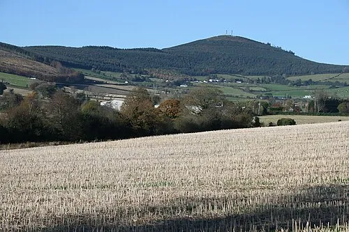 Slieveboy Mountain, County Wexford19 km N
-
Aughanall River River, County Wexford6.1 km SE
Sources & licences
Data last updated: · 2 independent sources