Kiltegan
Local name: Cill Téagáin
Located in County Wicklow, Leinster Coordinates: 52°54′18″ N 6°36′16″ W
- Elevation
- 156 m
- above sea level
- Local time
- UTC+00:00
- Europe/Dublin · UTC+00:00
About Kiltegan
Kiltegan is a village. Location: County Wicklow, Leinster. Elevation: 156 m.
Kiltegan (Irish: Cill Téagáin, meaning 'church of Tegan') is a village in west County Wicklow, Ireland, on the R747 regional road close to the border with County Carlow. The village is in a townland and civil parish of the same name. The civil parish extends into County Carlow. According to tradition, the village takes its Irish name, Cill Téagáin (meaning 'church of Tegan'), from a 5th century saint who was reputedly a disciple of Saint Patrick.
Read more on Wikipedia Text: Wikipedia contributors · CC BY-SA 4.0 · shortened
In comparison
- Nearest larger town: Hacketstown, 6 km SE
- 30 sights and natural places within 10 km Killegan Bridge, Humewood Castle
Nearby attractions & nature
Everything nearby-
Killegan Bridge Landmark, County Wicklow0.6 km S
-
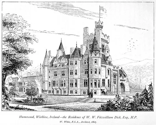 Humewood Castle Historic site, County Wicklow0.8 km NW
-
Crossnacole Bridge Landmark, County Wicklow0.9 km E
-
Carrig Mountain Mountain, County Wicklow4.3 km NE
-
Highpark Bridge Landmark, County Wicklow2.3 km E
-
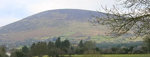 Keadeen Mountain Mountain, County Wicklow5.3 km N
Sources & licences
Data last updated: · 2 independent sources