Newtownshandrum
Local name: Baile Nua Sheandroma
Located in County Cork, Munster Coordinates: 52°21′00″ N 8°46′00″ W
- Population
- 394
- 394
- Elevation
- 105 m
- above sea level
- Local time
- UTC+00:00
- Europe/Dublin · UTC+00:00
About Newtownshandrum
Newtownshandrum is a village. Location: County Cork, Munster. Population: 394. Elevation: 105 m.
Newtownshandrum (Irish: Baile Nua Sheandroma) is a small village in County Cork, Ireland located 6.5 kilometres (4 mi) west of Charleville on the R515 road. The name translates from Irish to mean 'new town of the old ridge'. Historic maps from 1829 to 1841 and 1897–1913 identify the village as Newtown. Newtownshandrum is within the Dáil constituency of Cork North-West.
Read more on Wikipedia Text: Wikipedia contributors · CC BY-SA 4.0 · shortened
In comparison
- No. 73 of 121 places in County Cork by population
- Nearest larger town: Charleville, 6 km E
- 9 sights and natural places within 10 km Mullaheera River, Charleville Park
Nearby attractions & nature
Everything nearby-
Mullaheera River River, County Cork5.3 km SW
-
Garrane River River, County Cork7.9 km SE
-
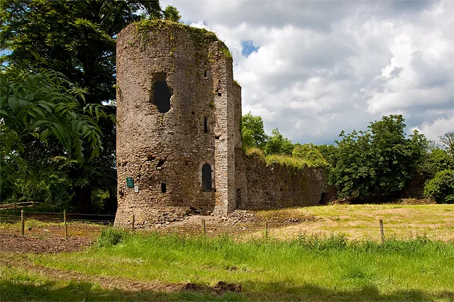 Kilbolane Castle Historic site, County Cork5.9 km W
-
Charleville Park Natural site, County Cork5.4 km E
-
Mountbridget Mountain, County Cork12 km S
-
Knockafutera Mountain, County Cork13 km SE
Sources & licences
Data last updated: · 2 independent sources