Ringaskiddy
Local name: Rinn an Scidígh
Located in County Cork, Munster Coordinates: 51°50′02″ N 8°19′01″ W
- Population
- 580
- 580
- Elevation
- 2 m
- above sea level
- Local time
- UTC+00:00
- Europe/Dublin · UTC+00:00
About Ringaskiddy
Ringaskiddy is a village. Location: County Cork, Munster. Population: 580. Elevation: 2 m.
Ringaskiddy (Irish: Rinn an Scidígh, meaning 'Skiddy's Headland') is a village in County Cork, Ireland. It is located on the western side of Cork Harbour, south of Cobh, and is 15 kilometres (9 mi) from Cork city, to which it is connected by the N28 road. The village is a port with passenger ferry, with six times weekly services to Boulogne-sur-Mer and two bi-weekly sailings to Roscoff in France. A ferry service to Swansea in Wales closed in 2012.
Read more on Wikipedia Text: Wikipedia contributors · CC BY-SA 4.0 · shortened
In comparison
- No. 50 of 121 places in County Cork by population
- Nearest larger town: Cobh, 2 km NE
- 50 sights and natural places within 10 km Ringaskiddy Island, Rocky Island
Nearby attractions & nature
Everything nearby-
Ringaskiddy Island Island, County Cork0.1 km S
-
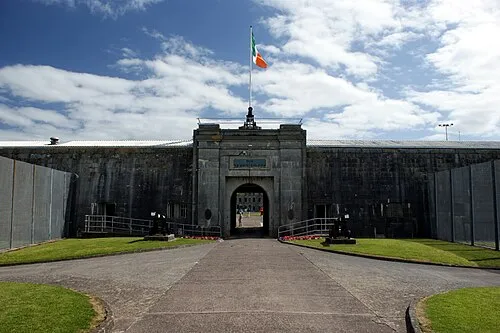 Spike Island Island, County Cork2.2 km E
-
Lough Beg Natural site, County Cork1.3 km S
-
Rocky Island Island, County Cork1.1 km E
-
Haulbowline Island Island, County Cork1.4 km NE
-
Titanic museum Museum, County Cork1.6 km N
Sources & licences
Data last updated: · 2 independent sources