Derrynasaggart Mountains
Local name: Cnoic Dhoire na Sagart
Located in County Kerry, Munster Coordinates: 51°59′00″ N 9°14′00″ W
- Elevation
- 388 m
- above sea level
- Local time
- UTC+00:00
- Europe/Dublin · UTC+00:00
About Derrynasaggart Mountains
Derrynasaggart Mountains is a mountain. Location: County Kerry, Munster. Elevation: 388 m.
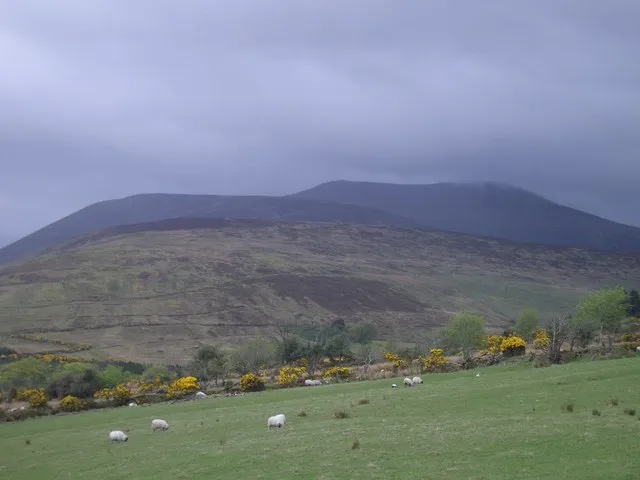
The Derrynasaggart Mountains, also spelled as Derry Na Saggart (Irish: Cnoic Dhoire na Sagart, "hills of the priests' oak-grove") are on the border of counties Cork and Kerry, in the province of Munster, Ireland. They surround the Clydagh River valley. The highest peaks are the Paps of Anu at 694 metres (2,277 ft) above sea level, followed by Caherbarnagh (681 m), and Mullaghanish (649 m). Other mountains and hills include Knocknabro (592 m), Claragh Mountain (452 m) and Knockbwee (461 m).
Read more on Wikipedia Text: Wikipedia contributors · CC BY-SA 4.0 · shortened
In comparison
- No. 837 of 2106 mountains in Ireland by elevation
- 51 sights and natural places within 10 km Lough Duff, Lough Carrignamork
Nearest towns and villages
-
Cammeenavrick Village, County Kerry1.3 km W
-
Clydagh Bridge Village, County Kerry4.3 km W
-
Cloonkeen Village, County Kerry4.6 km W
-
Colthurst Bridge Village, County Cork3.8 km SE
-
Poulgorm Bridge Village, County Kerry5.4 km W
-
Ballymakeery Village, County Cork8.8 km SE
Nearby attractions & nature
Everything nearby-
Knockacommeen Mountain, County Cork1.2 km SE
-
Lough Duff Lake, County Kerry0.7 km NW
-
Lough Carrignamork Lake, County Kerry1 km E
-
Knocknamork Mountain, County Cork2.3 km E
-
Lough Carrignafurark Lake, Ireland1.9 km SE
-
Knocknabro West Top Mountain, County Kerry3.5 km N
-
Bohill River River, County Kerry2.8 km NE
-
Lackabaun Mountain, County Cork4.4 km E
Sources & licences
Data last updated: · 2 independent sources