Derryveagh Mountains
Local name: Sléibhte Dhoire Bheatha
Located in County Donegal, Ulster Coordinates: 55°01′00″ N 8°03′00″ W
- Elevation
- 459 m
- above sea level
- Local time
- UTC+00:00
- Europe/Dublin · UTC+00:00
About Derryveagh Mountains
Derryveagh Mountains is a mountain. Location: County Donegal, Ulster. Elevation: 459 m.
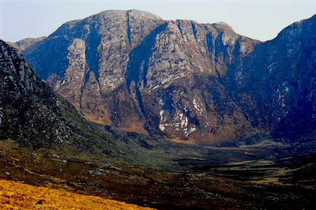
The Derryveagh Mountains (Irish: Cnoic Dhoire Bheatha) are the major mountain range in County Donegal, Ireland and part of Glenveagh National Park. The range makes up much of the landmass of the county and is the area of Ireland with the lowest population density. The mountains separate coastal parts of the county, such as Gweedore and Glenties, from the major inland towns such as Ballybofey and Letterkenny. The highest peak is Errigal, at 751 m (2,464 ft). The area features several hiking trails.
Read more on Wikipedia Text: Wikipedia contributors · CC BY-SA 4.0 · shortened
In comparison
- No. 585 of 2106 mountains in Ireland by elevation
- 79 sights and natural places within 10 km Lough Naweeloge, Staghall Mountain
Nearest towns and villages
-
Dún Lúiche Village, County Donegal3.2 km W
-
Gweedore Village, County Donegal12 km W
-
Glendowan Village, County Donegal7.9 km SE
-
Falcarragh Village, County Donegal13 km N
-
Cashelnagor Village, County Donegal8 km N
-
Corderry Village, County Donegal8.5 km SE
Nearby attractions & nature
Everything nearby-
Staghall Mountain Mountain, County Donegal0.9 km S
-
Maumlack Mountain, County Donegal1 km W
-
Lough Naweeloge Lake, County Donegal0.6 km SE
-
An Dubhais (mullach thiar theas) Mountain, County Donegal1.7 km N
-
Croloughan Lough Lake, County Donegal1.4 km NW
-
Dooish Mountain, County Donegal2.6 km NE
-
Cnoc Ui Mhaolruanaidh Mountain, County Donegal2.1 km S
-
Cnoc Bhealach Gaoithe Mountain, County Donegal2.2 km SW
Sources & licences
Data last updated: · 2 independent sources