Dún Lúiche
Located in County Donegal, Ulster Coordinates: 55°01′00″ N 8°06′00″ W
- Population
- 3,400
- 3.4K
- Elevation
- 111 m
- above sea level
- Local time
- UTC+00:00
- Europe/Dublin · UTC+00:00
About Dún Lúiche
Dún Lúiche is a village. Location: County Donegal, Ulster. Population: 3,400. Elevation: 111 m.
Dún Lúiche, known in English as Dunlewey or Dunlewy, is a small Gaeltacht village in the Gweedore district in the north-west of County Donegal in Ulster, the northern province in Ireland. The village sits in the Poisoned Glen, at the foot of Errigal and on the shore of Dunlewey Lough. The Cronaniv Burn flows along the southern edge of the village. Dunlewey has a tourist centre, called the Lakeside Centre or Ionad Cois Locha, which offers boat trips of the lake. To the west of the lake is a ruined church.
Read more on Wikipedia Text: Wikipedia contributors · CC BY-SA 4.0 · shortened
In comparison
- No. 5 of 66 places in County Donegal by population
- Nearest larger town: Gweedore, 9 km NW
- 77 sights and natural places within 10 km ERRIGAL-MOUNTAIN, Co. DONEGAL., Cronanty Burn
Nearby attractions & nature
Everything nearby-
Maumlack Mountain, County Donegal2.2 km E
-
ERRIGAL-MOUNTAIN, Co. DONEGAL. Historic site, County Donegal0.6 km W
-
Cronanty Burn River, County Donegal0.7 km W
-
Dunlewy Lake & Poisoned Glen Historic site, County Donegal1.1 km W
-
Devlin River River, County Donegal0.9 km W
-
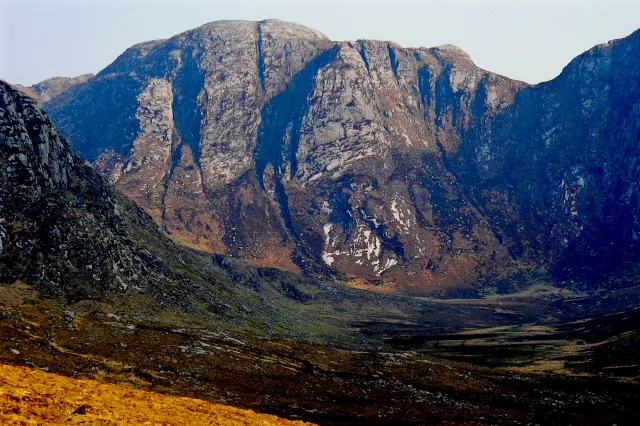 Derryveagh Mountains Mountain, County Donegal3.2 km E
Sources & licences
Data last updated: · 2 independent sources