- Population
- 159,192
- 159.2K
- Elevation
- 261 m
- above sea level
- Local time
- UTC+00:00
- Europe/Dublin · UTC+00:00
- Places inside
- 1,641
- listed under County Donegal
- Airports
- CFN Donegal Airport26 km
- LDY City of Derry Airport56 km
About County Donegal
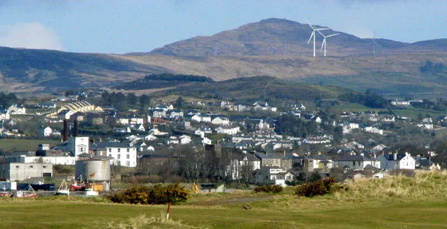
County Donegal is a district. Location: Ulster, Ireland. Population: 159,192. The nearest airport is Donegal Airport (26 km).
Climate of County Donegal
This month · November
A wet month
Day 9° · Night 4° · Rain 221 mm
- Hottest month
- July (day 16°)
- Coldest month
- January (night 2°)
- Wettest month
- January (230 mm)
- Driest month
- May (112 mm)
Bars: average monthly low and high temperature. Below: precipitation. Monthly averages for 1970–2000 at about 18 km resolution, adjusted for elevation. Highlighted months are mild and relatively dry. Source: WorldClim 2.1 (CC BY 4.0).
Show values as a table
| Month | Jan | Feb | Mar | Apr | May | Jun | Jul | Aug | Sep | Oct | Nov | Dec |
|---|---|---|---|---|---|---|---|---|---|---|---|---|
| Average high (°C) | 6° | 6° | 8° | 10° | 13° | 15° | 16° | 16° | 15° | 12° | 9° | 7° |
| Average low (°C) | 2° | 2° | 2° | 4° | 6° | 9° | 11° | 10° | 9° | 7° | 4° | 2° |
| Precipitation (mm) | 230 | 165 | 172 | 121 | 112 | 116 | 141 | 158 | 182 | 227 | 221 | 224 |
How to get to County Donegal
The nearest airport is Donegal Airport (CFN), 26 km to the northwest as the crow flies. For international flights: Belfast International Airport (BFS) (118 km). The nearest large city is Belfast, 138 km to the east.
Airports
- Donegal Airport (CFN) Donegal 26 kmnorthwest
- City of Derry Airport (LDY) Derry, Derry and Strabane 56 kmeast
- Belfast International Airport (BFS) Belfast 118 kmeast
Nearby large cities
- Belfast Population: 348K 138 kmeast
- Dublin Population: 1M 210 kmsoutheast
- Limerick Population: 102.3K 254 kmsouth
- Glasgow Population: 626.4K 260 kmnortheast
- Edinburgh Population: 515K 325 kmnortheast
Straight-line distances; road distances are longer. Airport data: OurAirports.
Places in County Donegal
1,641 placesCities & villages25
- Muckros · Village
- Muineagh · Village
- Mullagharry · Village
- Mullan · Village
- Mullanacross · Village
- Mullanasole · Village
- Mullanmore · Village
- Mullenieran Bridge · Village
- Mullingar · Village
- Mulnamin · Village
- Muntermellan · Village
- Murlas Bridge · Village
- Naran · Village
- Navenny · Village
- Newmills · Village
- Newtownburke · Village
- Old Mountain · Village
- Oldtown · Village
- Old Town · Village
- Old Town · Village
- Owenea Bridge · Village
- Parknatomogard · Village
- Pensylvania · Village
- Plaster · Village
- Pluck · Village
Mountains & nature13
- Muckros Head · Natural site
- Mullafin · Mountain
- Mullaghan Hill · Mountain
- Mullasawny · Mountain
- Mulmosog Mountain · Mountain
- Mulnanaff · Mountain
- Mulroy Bay · Natural site
- Murren Hill · Mountain
- Oughtadoony · Mountain
- Oughtadreen · Mountain
- Oughtarnid · Mountain
- Owenteskiny Hill · Mountain
- Pollaguill Bay · Natural site
Lakes, rivers & coasts22
- Mullaghderg Lough · Lake
- Nasnahida Lough · Lake
- Oily River · River
- Ominey River · River
- Owenator River · River
- Owenbeagh · River
- Owenbeg River · River
- Owenboy River · River
- Owencarrow River · River
- Owendoo River · River
- Owenea Lough · Lake
- Owenea River · River
- Owenerk River · River
- Owengarve River · River
- Owenkillew River · River
- Owennamarve River · River
- Owenteskiny River · River
- Owentocker River · River
- Owenwee River · River
- Owenwee River · River
- Owenwee River · River
- Owey Island · Island
Sources & licences
Data last updated: