Corno Rosso
Located in Piedmont, Italy Coordinates: 45°52′02″ N 7°52′08″ E
- Elevation
- 3,023 m
- above sea level
- Local time
- UTC+01:00
- Europe/Rome · UTC+01:00
About Corno Rosso
Corno Rosso is a mountain. Location: Piedmont, Italy. Elevation: 3,023 m.
The Corno Rosso (Walser: Ròthòre) is a mountain of the Pennine Alps, in northwestern Italy, with an elevation of 3,023 metres (9,918 ft). Part of the Monte Rosa massif, it is located on the border between the municipalities of Alagna Valsesia, Piedmont, and Gressoney-La-Trinité, Aosta Valley, on the drainage divide between the Lys Valley and the Valsesia. The Zube Pass, to its South, divides it from the Punta Straling; the Col d'Olen, to its north, divides it from the Corno del Camoscio.
Read more on Wikipedia Text: Wikipedia contributors · CC BY-SA 4.0 · shortened
At a glance
- Topographic prominence
- 142 m
Source: Wikidata
In comparison
- No. 401 of 4295 mountains in Italy by elevation
- 31 sights and natural places within 10 km Corno del Camoscio, Punta Starling
Nearest towns and villages
-
Alagna Valsesia Municipality, Province of Vercelli5.6 km E
-
Gressoney-La-Trinité Municipality, Province of Aosta5.5 km SW
-
Tschaval Village, Gressoney-La-Trinité4.3 km W
-
Staffal Village, Gressoney-La-Trinité4.5 km W
-
Alagna Valsesia Village, Alagna Valsesia5.6 km E
-
Gressoney-La-Trinitè Village, Gressoney-La-Trinité5.5 km SW
Nearby attractions & nature
Everything nearby-
Corno del Camoscio Mountain, Alagna Valsesia0.7 km N
-
Punta Starling Mountain, Piedmont1.5 km S
-
Corno Grosso Mountain, Piedmont2.5 km S
-
Punta Vittoria Mountain, Alagna Valsesia3.4 km N
-
Punta Giordani Mountain, Alagna Valsesia4.3 km N
-
Corno Bianco Mountain, Alagna Valsesia5 km S
-
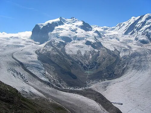 Dufourspitze Mountain, Zermatt7.7 km N
-
Corno Carro Mountain, Gressoney-Saint-Jean6.3 km S
Sources & licences
Data last updated: · 2 independent sources