Rauchkofel
Located in Italy Coordinates: 47°04′34″ N 12°05′31″ E
- Elevation
- 3,251 m
- above sea level
- Local time
- UTC+01:00
- Europe/Rome · UTC+01:00
About Rauchkofel
Rauchkofel is a mountain. Location: Italy. Elevation: 3,251 m.
The Rauhkofel or Rauchkofel (3,251 m (AA), Italian: Monte Fumo) is a summit on the main crest of the Zillertal Alps, which forms the border between the Austrian state of Tyrol and the Italian province of South Tyrol. The name of the mountain ("rugged peak") comes from the rugged appearance of the granite blocks that form the summit . The Rauhkofel rises above its neighbouring peaks on the main Zillertal ridge considerably and it is considered the best lookout mountain in the eastern Zillertal Alps.
Read more on Wikipedia Text: Wikipedia contributors · CC BY-SA 4.0 · shortened
In comparison
- No. 183 of 4295 mountains in Italy by elevation
- 95 sights and natural places within 10 km Gamsspitzl, Sauwipfel
Nearest towns and villages
-
Predoi/Prettau Municipality, South Tyrol4.1 km S
-
Prettau Village, Predoi/Prettau4.1 km S
-
Casere-Knappenegg Village, Predoi/Prettau3.9 km SE
-
Weiher Village, Predoi/Prettau4.5 km S
-
Brandberg Municipality, Politischer Bezirk Schwaz7.3 km NW
-
Marche Village, Ahrntal7.4 km SW
Nearby attractions & nature
Everything nearby-
Gamsspitzl Mountain, Predoi/Prettau0.9 km SE
-
Sauwipfel Mountain, Predoi/Prettau1.3 km S
-
Winkelkopf Mountain, Predoi/Prettau2.1 km E
-
Windbachspitze Mountain, Predoi/Prettau3.2 km E
-
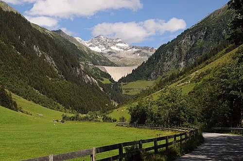 Zillergründl Natural site, Tyrol2.7 km N
-
Cima Triangolo Mountain, Austria3.1 km SW
-
Dreieckerspitze Mountain, Predoi/Prettau3.4 km E
-
Löffelspitze Mountain, Tyrol3.2 km SW
Sources & licences
Data last updated: · 2 independent sources