- Population
- 350,725
- 350.7K
- Elevation
- 136 m
- above sea level
- Local time
- UTC+01:00
- Europe/Rome · UTC+01:00
- Places inside
- 108
- listed under Province of South Sardinia
- Airports
- CAG Cagliari Elmas Airport42 km
- AHO Alghero-Fertilia Airport152 km
About Province of South Sardinia
Province of South Sardinia is a district. Location: Sardinia, Italy. Population: 350,725. The best months to visit are May–June, October. The nearest airport is Cagliari Elmas Airport (42 km).
Photos of Province of South Sardinia
-
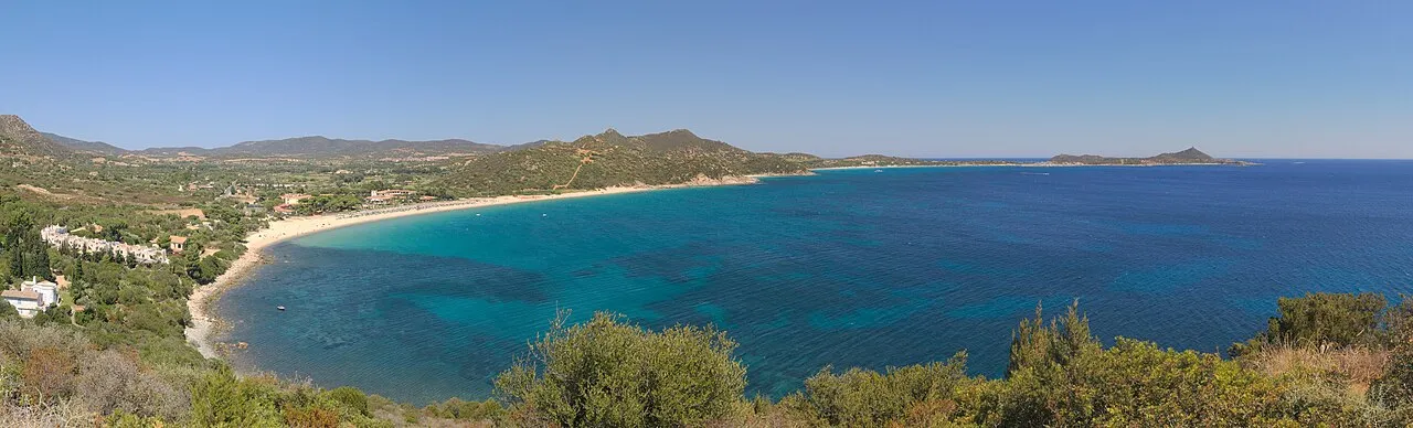
Spiaggia di Campulongu Javier Sanchez Portero · CC BY-SA 3.0 -
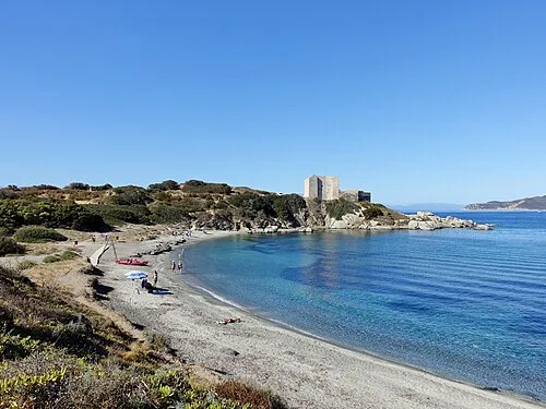
Spiaggia del Porto di Villasimius Olaf Tausch · CC BY 3.0 -
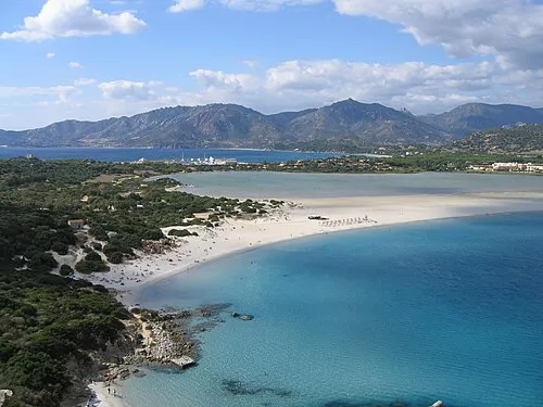
Spiaggia di Porto Giunco Robin Corps from Crowthorne, England · CC BY-SA 2.0 -
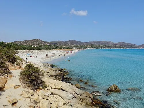
Spiaggia di Simius Olaf Tausch · CC BY 3.0 -
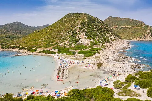
Spiaggia di Punta Molentis dronepicr · CC BY 2.0


Climate of Province of South Sardinia
Best months for sightseeingBest months for sightseeing: May–June, October.
This month · November
A wet month
Day 18° · Night 11° · Rain 100 mm
- Hottest month
- August (day 31°)
- Coldest month
- January (night 7°)
- Wettest month
- November (100 mm)
- Driest month
- July (5 mm)
Bars: average monthly low and high temperature. Below: precipitation. Monthly averages for 1970–2000 at about 18 km resolution, adjusted for elevation. Highlighted months are mild and relatively dry. Source: WorldClim 2.1 (CC BY 4.0).
Show values as a table
| Month | Jan | Feb | Mar | Apr | May | Jun | Jul | Aug | Sep | Oct | Nov | Dec |
|---|---|---|---|---|---|---|---|---|---|---|---|---|
| Average high (°C) | 14° | 14° | 16° | 18° | 23° | 27° | 30° | 31° | 27° | 23° | 18° | 15° |
| Average low (°C) | 7° | 7° | 8° | 10° | 13° | 17° | 20° | 20° | 18° | 15° | 11° | 8° |
| Precipitation (mm) | 73 | 78 | 64 | 61 | 36 | 18 | 5 | 10 | 40 | 75 | 100 | 81 |
How to get to Province of South Sardinia
The nearest airport is Cagliari Elmas Airport (CAG), 42 km to the east as the crow flies.
Airports
- Cagliari Elmas Airport (CAG) Cagliari 42 kmeast
- Alghero-Fertilia Airport (AHO) Alghero 152 kmnorth
- Olbia Costa Smeralda Airport (OLB) Olbia (SS) 198 kmnortheast
Straight-line distances; road distances are longer. Airport data: OurAirports.
Day trips from Province of South Sardinia
Within 100 km: 5 historic and cultural sites, 116 natural sites, 94 lakes, rivers and coasts.
0–25 km10 places
- Spiaggia di Portoscuso Beach 17 kmSW
- Ìsola Piana Island 23 kmSW
- Spiaggia Fontanamare Beach 11 kmW
- Portu Banda Beach 13 kmW
25–60 km75 places
- Poetto Beach 52 kmE
- Spiaggia di Quartu Beach 55 kmE
- Monte Santa Barbara Mountain 36 kmSE
- Monte Sant'Elia Mountain 52 kmE
60–100 km130 places
- Spiaggia di Tramatzu Beach 95 kmE
- Monte Cardiga Mountain 87 kmE
- Capo San Lotemzo Natural site 95 kmE
- Spiaggia di Marina di Capitana Beach 65 kmE
Straight-line distances.
Places in Province of South Sardinia
108 places- 61 Nuxis 1.5K
- 62 Musei 1.5K
- 63 Perdaxius 1.4K
- 64 Selegas 1.4K
- 65 Villanovafranca 1.3K
- 66 Masainas 1.3K
- 67 Seui 1.3K
- 68 Barumini 1.2K
- 69 Nurallao 1.2K
- 70 San Basilio 1.2K
- 71 Gesturi 1.2K
- 72 Gergei 1.2K
- 73 Pimentel 1.2K
- 74 Segariu 1.1K
- 75 Silius 1.1K
- 76 Suelli 1.1K
- 77 Barrali 1.1K
- 78 Villaperuccio 1.1K
- 79 Villanova Tulo 1.1K
- 80 Tratalias 1.1K
- 81 Buggerru 1.1K
- 82 Villasalto 1K
- 83 Tuili 1K
- 84 Guamaggiore 970
- 85 Sadali 940
- 86 Ortacesus 902
- 87 Nuragus 877
- 88 Piscinas 850
- 89 Gesico 835
- 90 Collinas 812
- 91 Seulo 808
- 92 Genoni 806
- 93 Ballao 771
- 94 San Nicolò Gerrei 743
- 95 Villanovaforru 654
- 96 Serri 653
- 97 Siddi 637
- 98 Esterzili 609
- 99 Pauli Arbarei 590
- 100 Escolca 576
- 101 Ussaramanna 517
- 102 Goni 473
- 103 Armungia 461
- 104 Turri 420
- 105 Genuri 311
- 106 Las Plassas 227
- 107 Setzu 139
Bar: population relative to the most populous place in this list.
Lakes, rivers & coasts1
- Spiaggia di Guidi · Beach
Nature and heritage in Province of South Sardinia
Sources & licences
Data last updated: