Mount Tsurugi
Local name: 剣山
Located in Naka Chō, Naka Gun Coordinates: 33°51′17″ N 134°05′44″ E
- Elevation
- 1,954 m
- above sea level
- Local time
- UTC+09:00
- Asia/Tokyo · UTC+09:00
- Airports
- TAK Takamatsu Airport41 km
- KCZ Kochi Ryoma Airport52 km
About Mount Tsurugi
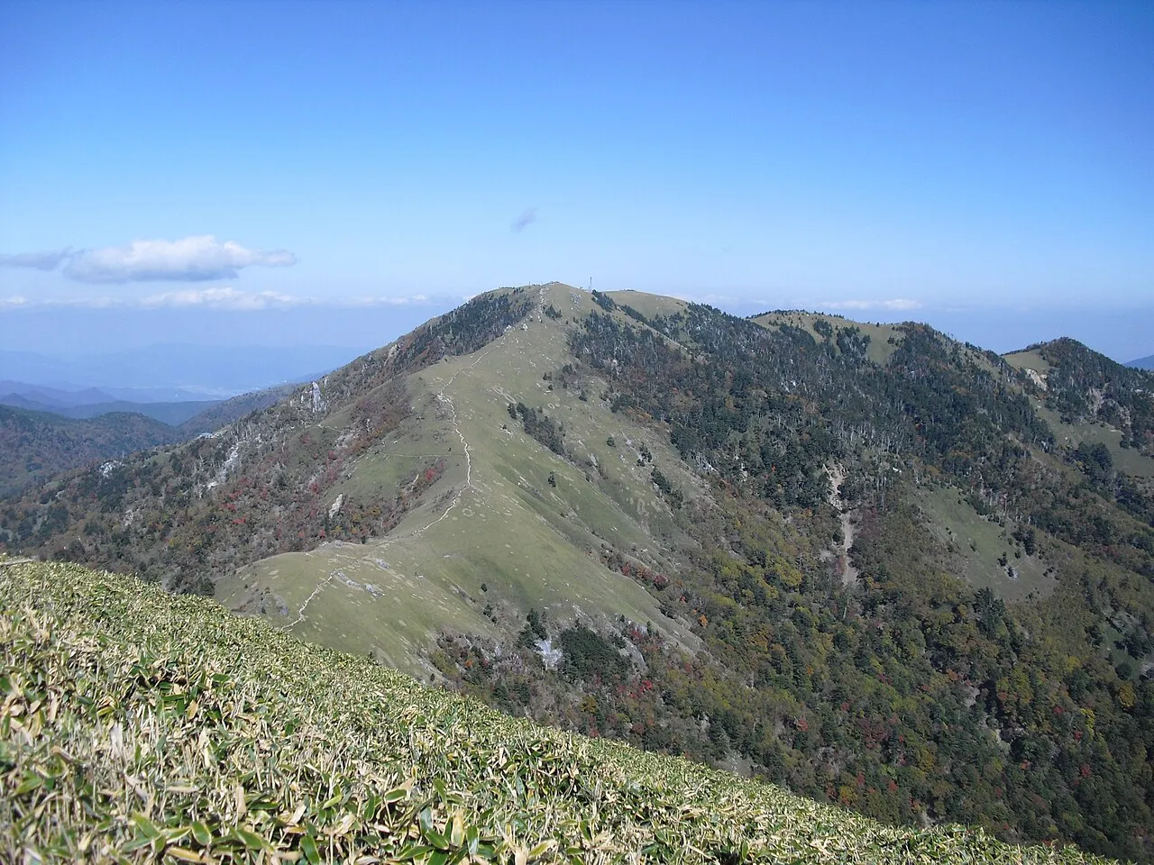
Mount Tsurugi is a mountain. Location: Naka Chō, Naka Gun. Elevation: 1,954 m.
Mount Tsurugi (剣山, Tsurugi-san), meaning sword, is a 1,954.7-metre-high (6,413.1 ft) mountain on the border of Miyoshi, Mima and Naka in Tokushima Prefecture, Japan. This mountain is one of the 100 Famous Japanese Mountains.
Source: Wikipedia · CC BY-SA 4.0
Photos of Mount Tsurugi
-

Koda6029 · CC BY-SA 4.0 -

Rémi Borfigat · CC BY 4.0 -

ブルーノ・プラス · CC BY 4.0 -

Dokudami · CC BY-SA 4.0 -

Araiyasushige · CC0


Climate of Mount Tsurugi
Best months for sightseeingBest months for sightseeing: August.
This month · November
A cold month
Day 4° · Night -3° · Rain 99 mm
Better nearby cities in November
- Kochi · 62 km southwest18°
- Ōita · 241 km west18°
- Beppu · 249 km west17°
- Hottest month
- August (day 18°)
- Coldest month
- January (night -11°)
- Wettest month
- June (334 mm)
- Driest month
- December (54 mm)
Bars: average monthly low and high temperature. Below: precipitation. Monthly averages for 1970–2000 at about 18 km resolution, adjusted for elevation. Highlighted months are mild and relatively dry. Source: WorldClim 2.1 (CC BY 4.0).
Show values as a table
| Month | Jan | Feb | Mar | Apr | May | Jun | Jul | Aug | Sep | Oct | Nov | Dec |
|---|---|---|---|---|---|---|---|---|---|---|---|---|
| Average high (°C) | -4° | -3° | 1° | 7° | 11° | 14° | 17° | 18° | 15° | 9° | 4° | -1° |
| Average low (°C) | -11° | -10° | -7° | -1° | 3° | 8° | 12° | 12° | 9° | 3° | -3° | -8° |
| Precipitation (mm) | 61 | 82 | 129 | 203 | 225 | 334 | 300 | 218 | 287 | 157 | 99 | 54 |
Other places to visit in this season: August
How to get to Mount Tsurugi
The nearest airport is Takamatsu Airport (TAK), 41 km to the north as the crow flies. The nearest large city is Tokushima, 49 km to the northeast.
Airports
- Takamatsu Airport (TAK) Takamatsu 41 kmnorth
- Kochi Ryoma Airport (KCZ) Nankoku 52 kmsouthwest
- Tokushima Awaodori Airport / JMSDF Tokushima Air Base (TKS) Tokushima 56 kmnortheast
Nearby large cities
- Tokushima Population: 267.3K 49 kmnortheast
- Takamatsu Population: 419K 53 kmnorth
- Marugame Population: 109.5K 56 kmnorthwest
- Kochi Population: 332.1K 62 kmsouthwest
- Niihama Population: 123.1K 74 kmwest
Straight-line distances; road distances are longer. Airport data: OurAirports.
Day trips from Mount Tsurugi
Within 100 km: 7 historic and cultural sites, 6 natural sites, 26 lakes, rivers and coasts.
25–60 km10 places
- Shikoku Island 56 kmW
- Nahari Gawa River 49 kmS
- Aki River River 43 kmSW
- Yashima Natural site 57 kmN
60–100 km29 places
- Awaji Island Island 90 kmNE
- Nao Shima Island 68 kmN
- Shiwaku Islands Island 68 kmNW
- Te Shima Island 69 kmN
Straight-line distances.
Nearest towns and villages
-
Tsurugi Chō Municipality, Mima Gun13 km N
-
Wakimachi Town, Mima Shi24 km N
-
Mima City, Mima Shi23 km N
-
Higashimiyoshi Chō Municipality, Miyoshi-gun26 km NW
-
Kamiyama Chō Municipality, Myōzai Gun26 km NE
-
Yoshinogawa City, Yoshinogawa Shi27 km NE
Sources & licences
Data last updated: · 2 independent sources