Kraków County
Located in Lesser Poland Voivodeship, Poland Coordinates: 50°08′36″ N 19°54′51″ E
- Population
- 278,219
- 278.2K
- Elevation
- 303 m
- above sea level
- Local time
- UTC+01:00
- Europe/Warsaw · UTC+01:00
- Places inside
- 17
- listed under Kraków County
About Kraków County
Kraków County is a district. Location: Lesser Poland Voivodeship, Poland. Population: 278,219.
Kraków County (Polish: powiat krakowski) is a unit of territorial administration and local government (powiat) in Lesser Poland Voivodeship, southern Poland. It came into being on January 1, 1999, as a result of the Polish local government reforms passed in 1998. Its administrative seat is the city of Kraków, although the city is not part of the county (it constitutes a separate city with powiat rights).
Read more on Wikipedia Text: Wikipedia contributors · CC BY-SA 4.0 · shortened
At a glance
- Built
- 1999
- Area
- 1,230 km²
Source: Wikidata
In comparison
- 3 sights and natural places within 10 km Craców Ghetto, Góra Chełmowa
- Listed here: Municipality: 17
Places in Kraków County
17 places-
Gmina Skawina Municipality43.4K
-
Gmina Krzeszowice Municipality32.3K
-
Zabierzów Municipality26.2K
-
Gmina Zielonki Municipality22.2K
-
Gmina Liszki Municipality17.1K
-
Gmina Kocmyrzów-Luborzyca Municipality15.3K
-
Czernichów Municipality14.5K
-
Gmina Mogilany Municipality13.8K
-
Gmina Słomniki Municipality13.7K
-
Gmina Wielka Wieś Municipality12K
-
Gmina Jerzmanowice-Przeginia Municipality10.9K
-
Gmina Skała Municipality10.5K
-
Gmina Michałowice Municipality10.4K
-
Świątniki Górne Municipality10K
-
Iwanowice Municipality9.1K
-
Gmina Igołomia-Wawrzeńczyce Municipality7.7K
-
Sułoszowa Municipality5.8K
Nature and heritage in Kraków County
-
Czyżowa Mountain, Gmina Krzeszowice
-
Łyse Skały Mountain, Gmina Jerzmanowice-Przeginia
-
Powroźnikowa Mountain, Gmina Jerzmanowice-Przeginia
-
Góra Chełmowa Mountain, Gmina Skała
-
Skawina Ghetto Historic site, Gmina Skawina
-
Krzeszowice Ghetto Historic site, Gmina Krzeszowice
Nearby attractions & nature
Everything nearby-
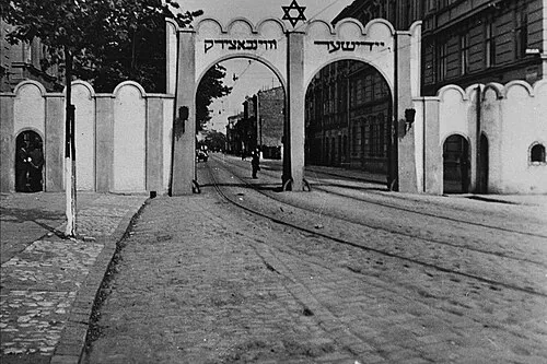 Craców Ghetto Historic site, Prądnik Biały6.7 km S
-
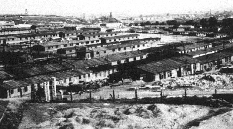 Plaszow Concentration Camp Historic site, Podgórze13 km S
-
Krakau Concentration Camp (Kabelwerke) Historic site, Stare Miasto9 km S
-
Wieliczka Concentration Camp Historic site, Wieliczka20 km SE
-
Wieliczka Ghetto Historic site, Wieliczka21 km SE
Sources & licences
Data last updated: · 2 independent sources