- Elevation
- 803 m
- above sea level
- Local time
- UTC+03:00
- Europe/Istanbul · UTC+03:00
- Airports
- EVN Zvartnots International Airport49 km
- IGD Iğdır Airport69 km
About Aşağı Kürtömer
Aşağı Kürtömer is a village. Location: Adıyaman Province, Turkey. Elevation: 803 m. The best months to visit are April–May, October. The nearest airport is Zvartnots International Airport (49 km). Nearby sights include Little Ararat and Karakaya Tepesi.
Climate of Aşağı Kürtömer
Best months for sightseeingBest months for sightseeing: April–May, October.
This month · November
Outside the best season
Day 13° · Night 2° · Rain 20 mm
Better nearby cities in November
- Silopi · 337 km southwest20°
- Cizre · 343 km southwest20°
- Hottest month
- July (day 34°)
- Coldest month
- January (night -6°)
- Wettest month
- May (44 mm)
- Driest month
- August (8 mm)
Bars: average monthly low and high temperature. Below: precipitation. Monthly averages for 1970–2000 at about 18 km resolution, adjusted for elevation. Highlighted months are mild and relatively dry. Source: WorldClim 2.1 (CC BY 4.0).
Show values as a table
| Month | Jan | Feb | Mar | Apr | May | Jun | Jul | Aug | Sep | Oct | Nov | Dec |
|---|---|---|---|---|---|---|---|---|---|---|---|---|
| Average high (°C) | 2° | 5° | 12° | 19° | 25° | 30° | 34° | 34° | 29° | 21° | 13° | 5° |
| Average low (°C) | -6° | -4° | 1° | 7° | 11° | 15° | 19° | 19° | 14° | 8° | 2° | -3° |
| Precipitation (mm) | 17 | 20 | 26 | 36 | 44 | 29 | 11 | 8 | 9 | 23 | 20 | 15 |
How to get to Aşağı Kürtömer
The nearest airport is Zvartnots International Airport (EVN), 49 km to the northwest as the crow flies. The nearest large city is Iğdır, 54 km to the west.
Airports
- Zvartnots International Airport (EVN) Yerevan 49 kmnorthwest
- Iğdır Airport (IGD) Iğdır 69 kmwest
- Nakhchivan International Airport (NAJ) Nakhchivan 94 kmsoutheast
Nearby large cities
- Iğdır Population: 101.7K 54 kmwest
- Ağrı Population: 124.5K 137 kmwest
- Van Population: 525K 176 kmsouthwest
- Ganja Population: 330.7K 180 kmnortheast
- Rustavi Population: 128.2K 203 kmnorth
Straight-line distances; road distances are longer. Airport data: OurAirports.
Day trips from Aşağı Kürtömer
Within 100 km: 6 historic and cultural sites, 91 natural sites, 47 lakes, rivers and coasts.
0–25 km6 places
- Tekaltıdağı Tepesi Mountain 18 kmW
- Karakaya Tepesi Mountain 11 kmW
- Rūdkhāneh-ye Qarah Sū River 12 kmSE
- Bozhane Deresi River 18 kmNW
25–60 km35 places
- Saz Gölü Lake 50 kmW
- Gölyüzü Gölü Lake 45 kmW
- Erhacı Gölü Lake 47 kmW
- Yalıntaşdağı Tepesi Mountain 56 kmW
60–100 km103 places
- Böyük Alagöl Lake 95 kmE
- Razvaliny Lizbirt Historic site 68 kmSE
- Lake Balık Lake 91 kmW
- Kazlıgöl Lake 78 kmSW
Straight-line distances.
Nearby attractions & nature
Everything nearby-
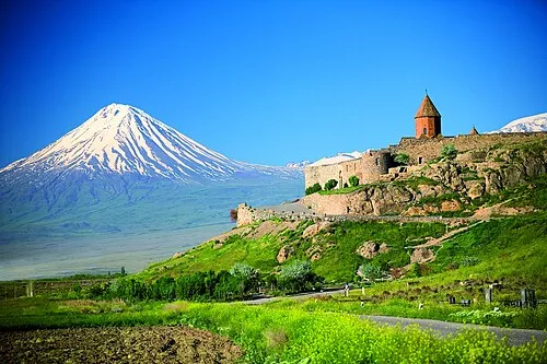 Little Ararat Mountain, Doğubayazıt District22 km SW
-
Karakaya Tepesi Mountain, Aralık İlçesi11 km W
-
Tekaltıdağı Tepesi Mountain, Aralık İlçesi18 km W
-
Gömik Historic site, Aralık İlçesi19 km W
-
Rūdkhāneh-ye Qarah Sū River, Turkey12 km SE
-
Bozhane Deresi River, Iğdır Province18 km NW
Sources & licences
Data last updated: