
- Population
- 64,643
- 64.6K
- Elevation
- 105 m
- above sea level
- Local time
- UTC+03:00
- Europe/Istanbul · UTC+03:00
- Places inside
- 20
- listed under Didim
- Airports
- BJV Milas Bodrum International Airport37 km
- SMI Samos Airport47 km
About Didim
Didim is a district. Location: Aydın Province, Turkey. Population: 64,643.
Didim is a municipality and district of Aydın Province, Turkey. Its area is 424 km2, and its population is 97,000 (2022). It is a popular seaside holiday resort on the Aegean coast of western Turkey, 123 km (76 mi) from the provincial capital city of Aydın. Didim is the site of the antique city of Didyma with its ruined Temple of Apollo.
Source: Wikipedia · CC BY-SA 4.0
At a glance
- Area
- 333 km²
Source: Wikidata
Photos of Didim
-
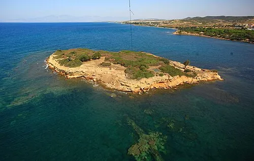
Yeşilada Tavşan_Adası_ · CC BY-SA 3.0 -
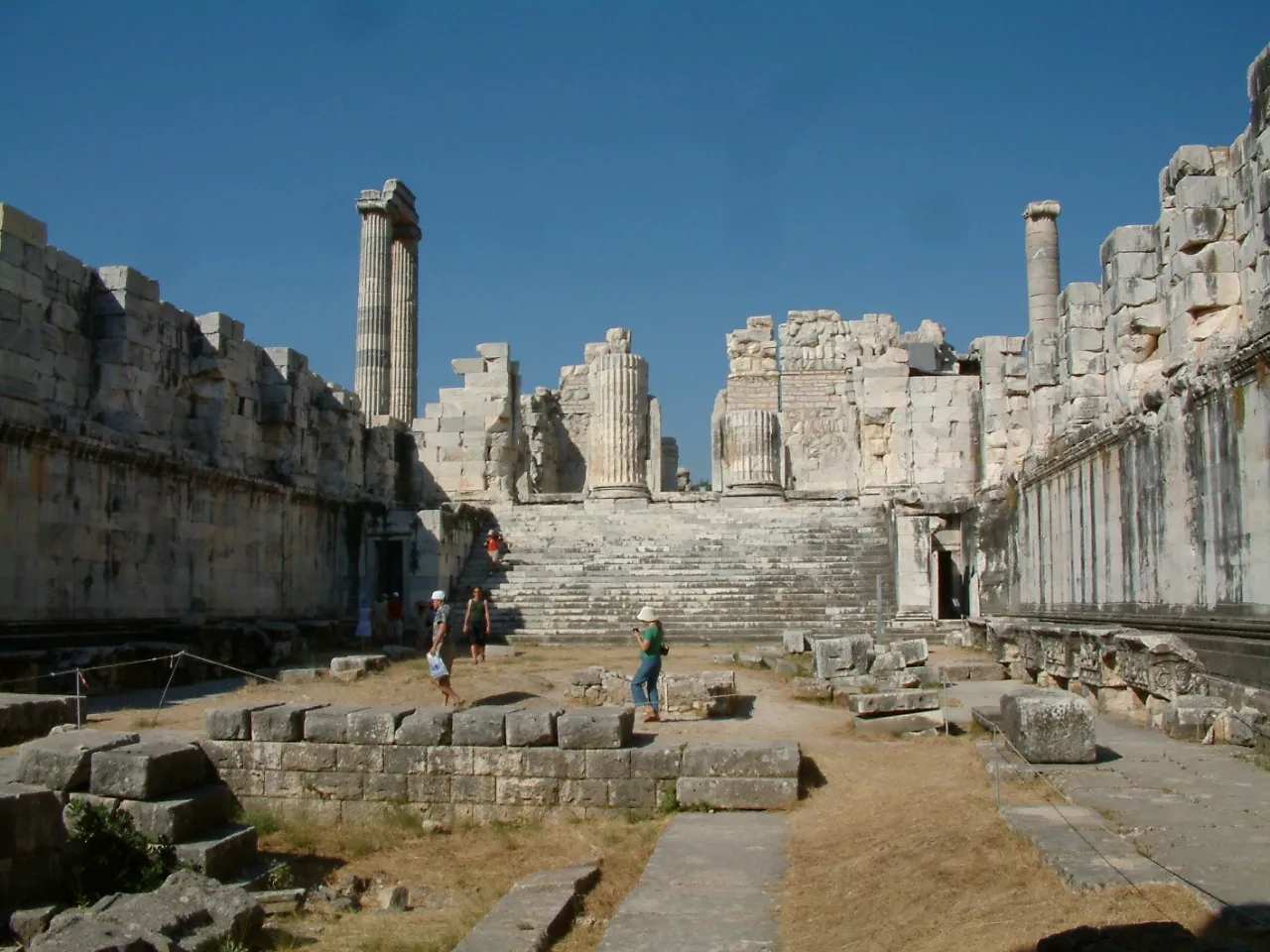
Didyma Wikimedia Commons · CC BY-SA 3.0


Travel notes for Didim
From Wikivoyage
Didim is a resort town on the Southern Aegean coast of Turkey. It's the most northerly of the resorts served by Milas-Bodrum Airport so in tourist brochures it's often described as "Bodrum region", and attracts a budget mass-market. In 2020 Didim had a population of 90,427.
The main sights of interest are the ancient Greek ruins of Priene, Miletus and Didyma, usually visited on a combined "PMD" day-trip.
Understand+
The ancient Greeks were sea-faring people, in an era when land transport involved packhorses on rough trails, and by the 8th century BC a network of ports and shipping routes criss-crossed the Aegean and East Med. From the 6th century these settlements were conquered by Persia, then by a series of later empires, but what did for them all was the silting up of the river valleys and receding of the coastline. The River Maeander or Büyük Menderes was the culprit hereabouts: Priene and Miletus relocated several times before being abandoned. Didyma by contrast was simply a ritual space with no associated town, but without its audience and funding of its oracles it too fell derelict.
The monuments were shattered by earthquakes and some stonework was removed for other use, but from the 20th century the sites were stabilised and partly restored. The small modern town of Hisar ("castle") grew up near Didyma, was wrecked by an earthquake in 1955, and rebuilt as Yenihisar ("new castle"). The big change to the area's fortunes came from the 1980s when Aegean Turkey became a mass tourist destination. The town migrated south, so Yenihisar became a northern residential district of Didim, while the major development was along the beach strip of Altınkum. The area was further boosted by the upgrade of Milas-Bodrum airport in 2000, so what had been a three-hour transfer from Izmir airport was reduced to an hour.
Get in+
Milas-Bodrum Airport (BJV IATA) 16 km south of Milas is the regional airport, with lots of seasonal package flights from north Europe. It has year-round daily flights from Istanbul, both IST and SAW.
Buses from Istanbul take 8 hours to Didim via Izmir, Selçuk (for Ephesus), Kuşadası and Söke. Between Didim and Bodrum take a dolmuş.
Bus companies are Metro Turizm, Pamukkale and Flixbus.
1 Didim Otobüs Terminali the bus station is 1.5 km east of the main boulevard.
By car from Istanbul follow O-5 to Izmir then E87 towards Aydın, cutting off onto D525 past Söke.
Source: Wikivoyage · CC BY-SA 4.0 · abridged
Climate of Didim
Best months for sightseeingBest months for sightseeing: April–May, October.
This month · November
Outside the best season
Day 19° · Night 10° · Rain 90 mm
Better nearby cities in November
- Aydin · 70 km northeast19°
- Hottest month
- July (day 34°)
- Coldest month
- January (night 6°)
- Wettest month
- December (152 mm)
- Driest month
- July (2 mm)
Bars: average monthly low and high temperature. Below: precipitation. Monthly averages for 1970–2000 at about 18 km resolution, adjusted for elevation. Highlighted months are mild and relatively dry. Source: WorldClim 2.1 (CC BY 4.0).
Show values as a table
| Month | Jan | Feb | Mar | Apr | May | Jun | Jul | Aug | Sep | Oct | Nov | Dec |
|---|---|---|---|---|---|---|---|---|---|---|---|---|
| Average high (°C) | 13° | 14° | 17° | 21° | 26° | 31° | 34° | 33° | 30° | 25° | 19° | 15° |
| Average low (°C) | 6° | 6° | 8° | 11° | 14° | 19° | 21° | 21° | 18° | 14° | 10° | 7° |
| Precipitation (mm) | 145 | 109 | 78 | 39 | 19 | 8 | 2 | 4 | 18 | 40 | 90 | 152 |
How to get to Didim
The nearest airport is Milas Bodrum International Airport (BJV), 37 km to the southeast as the crow flies. The nearest large city is Aydin, 70 km to the northeast.
Airports
- Milas Bodrum International Airport (BJV) Bodrum 37 kmsoutheast
- Samos Airport (SMI) Samos Island 47 kmnorthwest
- Kos International Airport "Ippokratis" (KGS) Kos Island 69 kmsouth
Nearby large cities
- Aydin Population: 163K 70 kmnortheast
- Nazilli Population: 119.4K 108 kmnortheast
- Karabağlar Population: 479.3K 111 kmnorth
- Konak Population: 332.3K 113 kmnorth
- Izmir Population: 2.9M 114 kmnorth
Straight-line distances; road distances are longer. Airport data: OurAirports.
Day trips from Didim
Within 100 km: 86 historic and cultural sites, 162 natural sites, 188 lakes, rivers and coasts.
0–25 km32 places
- Didem Plajı Beach 4 kmS
- Kapota Island Island 14 kmSE
- Panayır Adası Island 8 kmSE
- Dil Adaları Island 23 kmN
25–60 km164 places
- Moní Megális Panagías Attraction 52 kmNW
- Iasos Historic site 29 kmSE
- Nisída Krevvatió Island 54 kmS
- Kadınlar Plajı Beach 50 kmN
60–100 km240 places
- Taşlık Plajı Beach 82 kmSE
- Kumluk Plajı Beach 82 kmSE
- Hastanealtı Plajı Beach 82 kmSE
- Plati Island 84 kmSE
Straight-line distances.
Places in Didim
20 places
Didim
Population: 26K

Akbük
Population: 7.3K
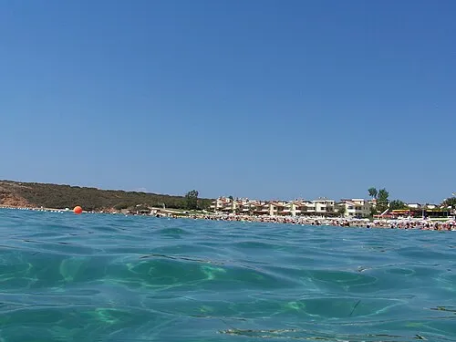
Altınkum
Population: 5.5K
Akyeniköy
Population: 2.7K
Yalıköy
Population: 2.5K
Akköy
Population: 1.1K
Bar: population relative to the most populous place in this list.
Cities & villages3
Mountains & nature1
- Kabahayt · Mountain
Lakes, rivers & coasts1
- Didem Plajı · Beach
Heritage & sights7
- Bafa VLF Transmitter, Mast North · Landmark
- Bafa VLF Transmitter, Mast South · Landmark
- Didyma · Historic site
- Faustina baths · Historic site
- İlyas Bey Mosque · Attraction
- Milet Harabeleri · Historic site
- Miletos · Historic site
Nearby attractions & nature
Everything nearby-
Palamut Dere River, Aydın Province4 km NW
-
Yeşilada Island, Aydın Province7.6 km NW
-
Panormus Portus Natural site, Aydın Province6 km W
-
Gökada Island, Aydın Province6.5 km SE
-
Panayır Adası Island, Aydın Province8 km SE
-
Akbük Köyü Natural site, Aydın Province8.4 km E
Sources & licences
Data last updated: · 2 independent sources