- Population
- 19,807
- 19.8K
- Elevation
- 524 m
- above sea level
- Local time
- UTC+03:00
- Europe/Istanbul · UTC+03:00
- Places inside
- 48
- listed under Karacasu
- Airports
- DNZ Çardak Airport98 km
- BJV Milas Bodrum International Airport99 km
About Karacasu
Karacasu is a district. Location: Aydın Province, Turkey. Population: 19,807. The best months to visit are May, October. The nearest airport is Çardak Airport (98 km). Nearby sights include Dedeler Deresi and Acı Dere.
Photos of Karacasu
-
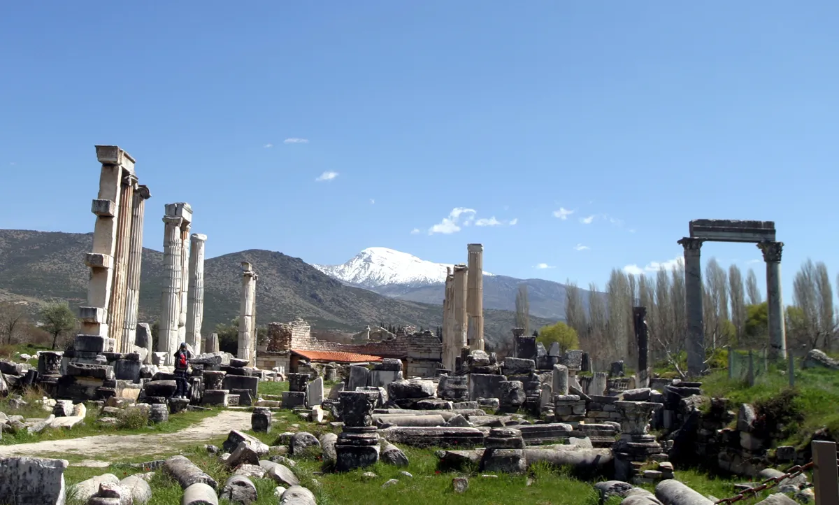
Aphrodisias Brocken Inaglory · CC BY-SA 4.0

Climate of Karacasu
Best months for sightseeingBest months for sightseeing: May, October.
This month · November
Outside the best season
Day 17° · Night 7° · Rain 80 mm
Better nearby cities in November
- Aydin · 67 km west19°
- Alanya · 330 km southeast21°
- Hottest month
- July (day 33°)
- Coldest month
- January (night 2°)
- Wettest month
- December (141 mm)
- Driest month
- August (8 mm)
Bars: average monthly low and high temperature. Below: precipitation. Monthly averages for 1970–2000 at about 18 km resolution, adjusted for elevation. Highlighted months are mild and relatively dry. Source: WorldClim 2.1 (CC BY 4.0).
Show values as a table
| Month | Jan | Feb | Mar | Apr | May | Jun | Jul | Aug | Sep | Oct | Nov | Dec |
|---|---|---|---|---|---|---|---|---|---|---|---|---|
| Average high (°C) | 10° | 11° | 15° | 19° | 25° | 30° | 33° | 33° | 29° | 23° | 17° | 12° |
| Average low (°C) | 2° | 3° | 5° | 8° | 12° | 16° | 19° | 19° | 15° | 11° | 7° | 4° |
| Precipitation (mm) | 125 | 103 | 77 | 53 | 41 | 22 | 11 | 8 | 16 | 42 | 80 | 141 |
How to get to Karacasu
The nearest airport is Çardak Airport (DNZ), 98 km to the east as the crow flies. For international flights: Milas Bodrum International Airport (BJV) (99 km). The nearest large city is Nazilli, 30 km to the northwest.
Airports
- Çardak Airport (DNZ) Denizli 98 kmeast
- Milas Bodrum International Airport (BJV) Bodrum 99 kmsouthwest
- Dalaman International Airport (DLM) Dalaman 116 kmsouth
Nearby large cities
- Nazilli Population: 119.4K 30 kmnorthwest
- Merkezefendi Population: 280.3K 40 kmeast
- Denizli Population: 313.2K 44 kmeast
- Aydin Population: 163K 67 kmwest
- Salihli Population: 119.3K 91 kmnorthwest
Straight-line distances; road distances are longer. Airport data: OurAirports.
Day trips from Karacasu
Within 100 km: 28 historic and cultural sites, 275 natural sites, 200 lakes, rivers and coasts.
0–25 km38 places
- Kemer Barajı Lake 20 kmS
- Karıncalı Dağı Mountain 15 kmNW
- Karınçalı Dağı Mountain 7 kmSW
- Dedebelen Tepesi Mountain 11 kmW
25–60 km140 places
- Arif'in Gölü Lake 34 kmNW
- Uyluk Dağı Mountain 50 kmSE
- Yılanlı Tepe Mountain 54 kmSE
- Yelkenli Dağı Mountain 57 kmSE
60–100 km325 places
- Karaca Adası Island 94 kmS
- Dairi Island Island 97 kmSW
- Gelibolu Adası Island 88 kmS
- Orata Adası Island 90 kmS
Straight-line distances.
Places in Karacasu
48 places- 1 Karacasu 6.2K
- 2 Ataeymir 1.1K
- 3 Ataköy 1.1K
- 4 Yenice 948
- 5 Işıklar 879
- 6 Geyre 774
- 7 Alemler 769
- 8 Esençay 675
- 9 Güzelköy 470
- 10 Palamutçuk 440
- 11 Çamköy 438
- 12 Karacaören 391
- 13 Yazır 389
- 14 Güzelbeyli 254
- 15 Dikmen 240
- 16 Tepecik 223
- 17 Bahçeköy 203
- 18 Yolüstü 199
- 19 Yolaltı 194
- 20 Gürle 190
- 21 Aşağıgörle 157
- 22 Nargedik 117
- 23 Hacıhıdırlar 109
- 24 Dedeler 107
- 25 Çamarası 83
- 26 Yeşilyurt 81
- 27 Bingeç 74
Bar: population relative to the most populous place in this list.
Cities & villages12
- Aşağı Dam · Village
- Çardak Mahellesi · Village
- Dereköy · Village
- Erikli Göl · Village
- Eski Damdere · Village
- Karabağlar · Village
- Muduvar Mahallesi · Village
- Nebidamları · Village
- Tokuşlar · Village
- Yaygın · Village
- Yeniköy · Village
- Yeşilköy · Village
Mountains & nature7
- Avdan Dağı · Mountain
- Danışman Tepesi · Mountain
- Gümüşmaden Tepesi · Mountain
- Hançam Tepesi · Mountain
- Kızmezarı Tepesi · Mountain
- Koca Tepe · Mountain
- Yatak Dağı · Mountain
Heritage & sights2
- Aphrodisias · Historic site
- Aphrodisias Museum · Museum
Nearby attractions & nature
Everything nearby-
Dedeler Deresi River, Aydın Province2.7 km E
-
Acı Dere River, Aydın Province3 km NE
-
Karınçalı Dağı Mountain, Bozdoğan İlçesi6.8 km SW
-
Seyret Deresi River, Aydın Province7.7 km NW
-
Alibey Deresi River, Aydın Province8 km NE
-
Geyre Çayı River, Turkey7.2 km SE
Sources & licences
Data last updated: