Bigadiç Bucağı
Located in Balıkesir Province, Turkey Coordinates: 39°23′33″ N 28°07′35″ E
- Elevation
- 157 m
- above sea level
- Local time
- UTC+03:00
- Europe/Istanbul · UTC+03:00
- Airports
- BZI Balıkesir Airport31 km
- EDO Balıkesir Koca Seyit Airport98 km
About Bigadiç Bucağı
Bigadiç Bucağı is a municipality. Location: Balıkesir Province, Turkey. Elevation: 157 m. The best months to visit are April–May, October. The nearest airport is Balıkesir Airport (31 km). Nearby sights include Simav Çayı and Gölcük Deresi.
Climate of Bigadiç Bucağı
Best months for sightseeingBest months for sightseeing: April–May, October.
This month · November
Outside the best season
Day 16° · Night 6° · Rain 76 mm
Better nearby cities in November
- Aydin · 174 km south19°
- Hottest month
- July (day 32°)
- Coldest month
- January (night 1°)
- Wettest month
- December (117 mm)
- Driest month
- July (11 mm)
Bars: average monthly low and high temperature. Below: precipitation. Monthly averages for 1970–2000 at about 18 km resolution, adjusted for elevation. Highlighted months are mild and relatively dry. Source: WorldClim 2.1 (CC BY 4.0).
Show values as a table
| Month | Jan | Feb | Mar | Apr | May | Jun | Jul | Aug | Sep | Oct | Nov | Dec |
|---|---|---|---|---|---|---|---|---|---|---|---|---|
| Average high (°C) | 9° | 11° | 14° | 20° | 25° | 30° | 32° | 32° | 29° | 22° | 16° | 11° |
| Average low (°C) | 1° | 2° | 3° | 7° | 11° | 15° | 17° | 17° | 13° | 10° | 6° | 3° |
| Precipitation (mm) | 97 | 76 | 67 | 56 | 42 | 23 | 11 | 11 | 23 | 44 | 76 | 117 |
How to get to Bigadiç Bucağı
The nearest airport is Balıkesir Airport (BZI), 31 km to the northwest as the crow flies. For international flights: Balıkesir Koca Seyit Airport (EDO) (98 km). The nearest large city is Balıkesir, 35 km to the northwest.
Airports
- Balıkesir Airport (BZI) Balıkesir 31 kmnorthwest
- Balıkesir Koca Seyit Airport (EDO) Edremit 98 kmwest
- Mytilene International Airport (MJT) Mytilene 137 kmwest
Nearby large cities
- Balıkesir Population: 238.2K 35 kmnorthwest
- Mustafakemalpaşa Population: 101.4K 76 kmnorth
- Salihli Population: 119.3K 101 kmsouth
- Manisa Population: 244K 106 kmsouthwest
- Turgutlu Population: 103.3K 106 kmsouth
Straight-line distances; road distances are longer. Airport data: OurAirports.
Day trips from Bigadiç Bucağı
Within 100 km: 20 historic and cultural sites, 162 natural sites, 194 lakes, rivers and coasts.
0–25 km28 places
- Kocabey Göleti Lake 9 kmSE
- Yumaklı Dağ Mountain 21 kmW
- Ulus Dağı Mountain 24 kmE
- Türkmen Tepe Mountain 14 kmW
25–60 km97 places
- Taş Dağı Mountain 46 kmSW
- Köse Dağı Mountain 56 kmSW
- Şifa Dağı Mountain 41 kmW
- Seydan Dağı Mountain 31 kmS
60–100 km251 places
- Mutlu Adası Island 96 kmNE
- Halilbey Adası Island 95 kmNE
- Terzioğlu Adası Island 98 kmNE
- Simav Gölü Lake 73 kmE
Straight-line distances.
Nearby attractions & nature
Everything nearby-
Simav Çayı River, Balıkesir Province3.5 km NW
-
Gölcük Deresi River, Balıkesir Province8.1 km SW
-
Kocabey Göleti Lake, Balıkesir Province9.4 km SE
-
Karyağdı Tepesi Mountain, Bigadiç İlçesi7.5 km N
-
Uzunçam Deresi River, Balıkesir Province12 km NE
-
Murtan Kıranı Tepesi Mountain, Sındırgı İlçesi15 km SE
-
Kartal Deresi River, Balıkesir Province13 km E
-
Koz Deresi River, Balıkesir Province14 km NW
Other cities and towns in Balıkesir Province
-
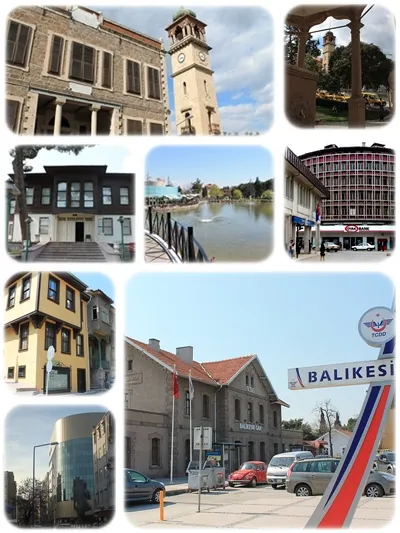 Balıkesir City, Balıkesir Province35 km NW
-
Gölcük Bucağı Municipality, Balıkesir Province13 km SW
-
Sındırgı City, Sındırgı İlçesi17 km S
-
Sındırgı Bucağı Municipality, Balıkesir Province16 km S
-
Çağış Bucağı Municipality, Balıkesir Province17 km NW
-
Yağcılar Bucağı Municipality, Balıkesir Province24 km E
Sources & licences
Data last updated: