Bingöl Province
Local name: Bingöl ili
Located in Turkey Coordinates: 39°05′00″ N 40°50′00″ E
- Population
- 282,556
- 282.6K
- Elevation
- 1,807 m
- above sea level
- Local time
- UTC+03:00
- Europe/Istanbul · UTC+03:00
- Places inside
- 176
- listed under Bingöl Province
- Airports
- BGG Bingöl Airport32 km
- MSR Muş Airport81 km
About Bingöl Province
Bingöl Province is a region. Location: Turkey. Population: 282,556.
Bingöl Province (Turkish: Bingöl ili; Kurdish: Parêzgeha Çewlîg; Zazaki: Wîlayetî Çewlîg; Armenian: Ճապաղջուր զավառ) is a province of Turkey. The province was known as Çapakçur Province (Armenian: Ճապաղջուր, lit. 'spread out water') before 1945 when it was renamed as Bingöl Province. Its area is 8,003 km2, and its population is 282,556 (2022). The province encompasses 11 municipalities, 325 villages and 693 hamlets.
Source: Wikipedia · CC BY-SA 4.0
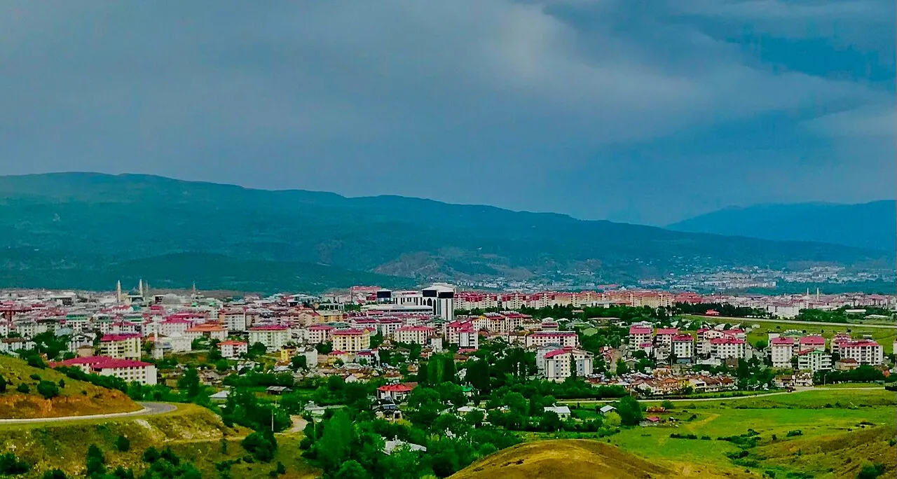
Photos of Bingöl Province
-

Mehmet akdeniz · CC0 -

Earth Science and Remote Sensing Unit, NASA Johnson Space Center · Public domain -

Saigen Jiro · CC0 -

Perencal · CC BY-SA 3.0


Places bordering Bingöl Province
Climate of Bingöl Province
Best months for sightseeingBest months for sightseeing: June, September.
This month · November
A wet month
Day 9° · Night -1° · Rain 100 mm
Better nearby cities in November
- Kızıltepe · 212 km south19°
- Viranşehir · 227 km southwest18°
- Cizre · 228 km southeast20°
- Hottest month
- August (day 29°)
- Coldest month
- January (night -9°)
- Wettest month
- April (126 mm)
- Driest month
- August (8 mm)
Bars: average monthly low and high temperature. Below: precipitation. Monthly averages for 1970–2000 at about 18 km resolution, adjusted for elevation. Highlighted months are mild and relatively dry. Source: WorldClim 2.1 (CC BY 4.0).
Show values as a table
| Month | Jan | Feb | Mar | Apr | May | Jun | Jul | Aug | Sep | Oct | Nov | Dec |
|---|---|---|---|---|---|---|---|---|---|---|---|---|
| Average high (°C) | -1° | 0° | 4° | 11° | 18° | 24° | 29° | 29° | 25° | 17° | 9° | 1° |
| Average low (°C) | -9° | -8° | -4° | 2° | 6° | 11° | 15° | 14° | 10° | 5° | -1° | -6° |
| Precipitation (mm) | 99 | 97 | 103 | 126 | 91 | 31 | 10 | 8 | 14 | 68 | 100 | 104 |
How to get to Bingöl Province
The nearest airport is Bingöl Airport (BGG), 32 km to the southwest as the crow flies. The nearest large city is Bingoel, 37 km to the southwest.
Airports
- Bingöl Airport (BGG) Bingöl 32 kmsouthwest
- Muş Airport (MSR) Muş 81 kmsoutheast
- Erzurum International Airport (ERZ) Erzurum 101 kmnorth
Nearby large cities
- Bingoel Population: 128.9K 37 kmsouthwest
- Erzurum Population: 767.8K 99 kmnorth
- Batman Population: 452.2K 135 kmsouth
- Erzincan Population: 150.7K 137 kmnorthwest
- Diyarbakır Population: 1.8M 141 kmsouthwest
Straight-line distances; road distances are longer. Airport data: OurAirports.
Places in Bingöl Province
176 places- 1 Bingol 143.6K
- 2 Genç İlçesi 36K
- 3 Solhan İlçesi 33.5K
- 4 Karlıova İlçesi 32.2K
- 5 Adaklı İlçesi 9.4K
- 6 Kiğı İlçesi 5.5K
- 7 Yedisu İlçesi 3.1K
- 8 Yayladere İlçesi 2.1K
- 9 Çayağzı 187
- 10 Sürmelikoç 122
Bar: population relative to the most populous place in this list.
Cities & villages10
- Adaklı Bucağı · Municipality
- Akçayurt · Village
- Alabalık · Village
- Avlik · Village
- Babaderesi · Village
- Bayındır · Village
- Çayırtepe · Village
- Çimenözü · Village
- Demirtaş · Village
- Dutköy · Village
Mountains & nature5
- Atmaca Tepesi · Mountain
- Cavreş Dağı · Mountain
- Çevrili Tepe · Mountain
- Çiriş Dağları · Mountain
- Duttepe · Mountain
Lakes, rivers & coasts35
- Adaklı Deresi · River
- Akça Dere · River
- Aktoprak Dere · River
- Amasya Deresi · River
- Arakol Deresi · River
- Aşağıgökçekanat Çayı · River
- Avzak Dere · River
- Aydere · River
- Aydere · River
- Aydınca Dere · River
- Azinan Dere · River
- Bahri Gölü · Lake
- Balıkçın Dere · River
- Balpınar Dere · River
- Bayram Çayı · River
- Beşevler Dere · River
- Börek Dere · River
- Bulanık Dere · River
- Bülbül Deresi · River
- Büyük Çay · River
- Büyük Dere · River
- Büyük Dere · River
- Büyüksu Deresi · River
- Çatak Deresi · River
- Çavuşlar Dere · River
- Cayit Barajı · Lake
- Çayırlık Deresi · River
- Ceban Deresi · River
- Cin Deresi · River
- Copissuyu · River
- Corivanksuyu · River
- Dalsı Dere · River
- Değirmen Deresi · River
- Değirmen Deresi · River
- Düzce Dere · River
Largest cities and towns
Nature and heritage in Bingöl Province
Sources & licences
Data last updated: · 2 independent sources