- Elevation
- 1,043 m
- above sea level
- Local time
- UTC+03:00
- Europe/Istanbul · UTC+03:00
- Airports
- BGG Bingöl Airport7 km
- MSR Muş Airport99 km
About Bulanık Dere
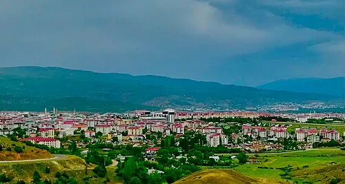
Bulanık Dere is a river. Location: Bingöl Province, Turkey. The best months to visit are May, October. The nearest airport is Bingöl Airport (7 km). Nearby sights include İdsuyu and Göynük Çayı.
Climate of Bulanık Dere
Best months for sightseeingBest months for sightseeing: May, October.
This month · November
Outside the best season
Day 14° · Night 3° · Rain 95 mm
Better nearby cities in November
- Kızıltepe · 191 km south19°
- Viranşehir · 199 km south18°
- Cizre · 227 km southeast20°
- Hottest month
- August (day 35°)
- Coldest month
- January (night -5°)
- Wettest month
- January (120 mm)
- Driest month
- August (5 mm)
Bars: average monthly low and high temperature. Below: precipitation. Monthly averages for 1970–2000 at about 18 km resolution, adjusted for elevation. Highlighted months are mild and relatively dry. Source: WorldClim 2.1 (CC BY 4.0).
Show values as a table
| Month | Jan | Feb | Mar | Apr | May | Jun | Jul | Aug | Sep | Oct | Nov | Dec |
|---|---|---|---|---|---|---|---|---|---|---|---|---|
| Average high (°C) | 3° | 5° | 10° | 17° | 23° | 30° | 35° | 35° | 31° | 22° | 14° | 6° |
| Average low (°C) | -5° | -4° | 1° | 6° | 11° | 15° | 20° | 19° | 14° | 9° | 3° | -2° |
| Precipitation (mm) | 120 | 112 | 117 | 116 | 79 | 23 | 7 | 5 | 10 | 58 | 95 | 108 |
How to get to Bulanık Dere
The nearest airport is Bingöl Airport (BGG), 7 km to the southeast as the crow flies. The nearest large city is Bingoel, 4 km to the southwest.
Airports
- Bingöl Airport (BGG) Bingöl 7 kmsoutheast
- Muş Airport (MSR) Muş 99 kmeast
- Elazığ Airport (EZS) Elazığ 114 kmwest
Nearby large cities
- Bingoel Population: 128.9K 4 kmsouthwest
- Diyarbakır Population: 1.8M 113 kmsouth
- Elâzığ Population: 443.4K 117 kmwest
- Batman Population: 452.2K 124 kmsoutheast
- Erzurum Population: 767.8K 129 kmnortheast
Straight-line distances; road distances are longer. Airport data: OurAirports.
Day trips from Bulanık Dere
Within 100 km: 7 historic and cultural sites, 656 natural sites, 505 lakes, rivers and coasts.
0–25 km62 places
- Cayit Barajı Lake 23 kmNW
- Yayla Tepe Mountain 12 kmN
- Şakorat Dağı Mountain 11 kmNW
- Körhızır Dağı Mountain 23 kmW
25–60 km234 places
- Dipni Barajı Lake 55 kmSW
- Özlüce Barajı Lake 43 kmNW
- Ziyaret Tepesi Mountain 26 kmS
- Yaylım Dağı Mountain 40 kmSE
60–100 km872 places
- Seki Gölü Lake 85 kmNE
- Keban Barajı Gölü Lake 95 kmW
- Batman Barajı Lake 89 kmSE
- Silvan Barajı Lake 63 kmSE
Straight-line distances.
Nearest towns and villages
Nearby attractions & nature
Everything nearby-
İdsuyu River, Bingöl Province3.6 km SE
-
Göynük Çayı River, Bingöl Province3.6 km SE
-
Düzce Dere River, Bingöl Province3.9 km SE
-
Koçan Deresi River, Bingöl Province4.4 km SE
-
Lihan Deresi River, Bingöl Province4.5 km E
-
Bayram Çayı River, Bingöl Province5.3 km SE
-
Pemisa Dere River, Bingöl Province5.6 km W
-
Nazik Tepe Mountain, Bingol8.2 km E
Sources & licences
Data last updated: