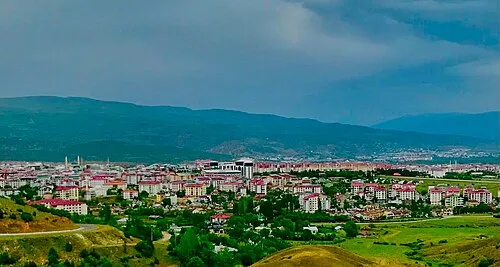
Yayladere Bucağı
Located in Bingöl Province, Turkey Coordinates: 39°13′18″ N 40°03′57″ E
- Elevation
- 1,594 m
- above sea level
- Local time
- UTC+03:00
- Europe/Istanbul · UTC+03:00
- Airports
- BGG Bingöl Airport61 km
- ERC Erzincan Airport71 km
About Yayladere Bucağı
Yayladere Bucağı is a municipality. Location: Bingöl Province, Turkey. Elevation: 1,594 m. The best months to visit are May–June, September. The nearest airport is Bingöl Airport (61 km). Nearby sights include Hadar Dağı and Salbüs Dağı.
Climate of Yayladere Bucağı
Best months for sightseeingBest months for sightseeing: May–June, September.
This month · November
A wet month
Day 10° · Night 1° · Rain 106 mm
Better nearby cities in November
- Viranşehir · 224 km south18°
- Kızıltepe · 230 km south19°
- Cizre · 280 km southeast20°
- Hottest month
- August (day 30°)
- Coldest month
- January (night -7°)
- Wettest month
- April (123 mm)
- Driest month
- August (6 mm)
Bars: average monthly low and high temperature. Below: precipitation. Monthly averages for 1970–2000 at about 18 km resolution, adjusted for elevation. Highlighted months are mild and relatively dry. Source: WorldClim 2.1 (CC BY 4.0).
Show values as a table
| Month | Jan | Feb | Mar | Apr | May | Jun | Jul | Aug | Sep | Oct | Nov | Dec |
|---|---|---|---|---|---|---|---|---|---|---|---|---|
| Average high (°C) | 1° | 2° | 6° | 14° | 20° | 25° | 30° | 30° | 26° | 18° | 10° | 3° |
| Average low (°C) | -7° | -6° | -2° | 4° | 8° | 12° | 16° | 16° | 12° | 6° | 1° | -4° |
| Precipitation (mm) | 107 | 98 | 102 | 123 | 97 | 31 | 8 | 6 | 13 | 69 | 106 | 119 |
How to get to Yayladere Bucağı
The nearest airport is Bingöl Airport (BGG), 61 km to the southeast as the crow flies. The nearest large city is Bingoel, 53 km to the southeast.
Airports
- Bingöl Airport (BGG) Bingöl 61 kmsoutheast
- Erzincan Airport (ERC) Erzincan 71 kmnorthwest
- Elazığ Airport (EZS) Elazığ 97 kmsouthwest
Nearby large cities
- Bingoel Population: 128.9K 53 kmsoutheast
- Erzincan Population: 150.7K 76 kmnorthwest
- Elâzığ Population: 443.4K 95 kmsouthwest
- Erzurum Population: 767.8K 129 kmnortheast
- Diyarbakır Population: 1.8M 146 kmsouth
Straight-line distances; road distances are longer. Airport data: OurAirports.
Day trips from Yayladere Bucağı
Within 100 km: 8 historic and cultural sites, 812 natural sites, 552 lakes, rivers and coasts.
0–25 km31 places
- Özlüce Barajı Lake 11 kmSE
- Sancak Tepesi Mountain 23 kmSE
- Saban Dağı Mountain 23 kmN
- Hadar Dağı Mountain 4 kmNE
25–60 km203 places
- Cayit Barajı Lake 31 kmSE
- Yayla Tepe Mountain 51 kmSE
- Ziri Dağı Mountain 54 kmSW
- Yeldağı Tepe Mountain 32 kmW
60–100 km1,138 places
- Lake Hazar Lake 100 kmSW
- Keban Barajı Gölü Lake 81 kmSW
- Dipni Barajı Lake 86 kmS
- Koç Gölü Lake 72 kmNW
Straight-line distances.
Nearby attractions & nature
Everything nearby-
Hadar Dağı Mountain, Yayladere İlçesi4.3 km NE
-
Salbüs Dağı Mountain, Bingöl Province8.9 km NW
-
Büyük Dere River, Bingöl Province7.2 km SE
-
Çadırdağı Tepe Mountain, Yayladere İlçesi6.5 km NW
-
Tahkim Tepesi Mountain, Tunceli Province10 km W
-
Corivanksuyu River, Bingöl Province12 km S
-
Boncuk Dağı Mountain, Tunceli Province10 km W
-
Sevdin Dağları Mountain, Turkey12 km N
Other cities and towns in Bingöl Province
-
 Bingoel City, Bingol53 km SE
-
Kiğı Bucağı Municipality, Bingöl Province26 km E
-
Sancak Bucağı Municipality, Bingöl Province31 km SE
-
Adaklı Bucağı Municipality, Bingöl Province36 km E
-
Yedisu City, Yedisu İlçesi47 km NE
-
Kiğı City, Kiğı İlçesi27 km NE
Sources & licences
Data last updated: