- Population
- 29,234
- 29.2K
- Elevation
- 819 m
- above sea level
- Local time
- UTC+03:00
- Europe/Istanbul · UTC+03:00
- Airports
- ISE Süleyman Demirel International Airport48 km
- AYT Antalya International Airport65 km
About Bucak
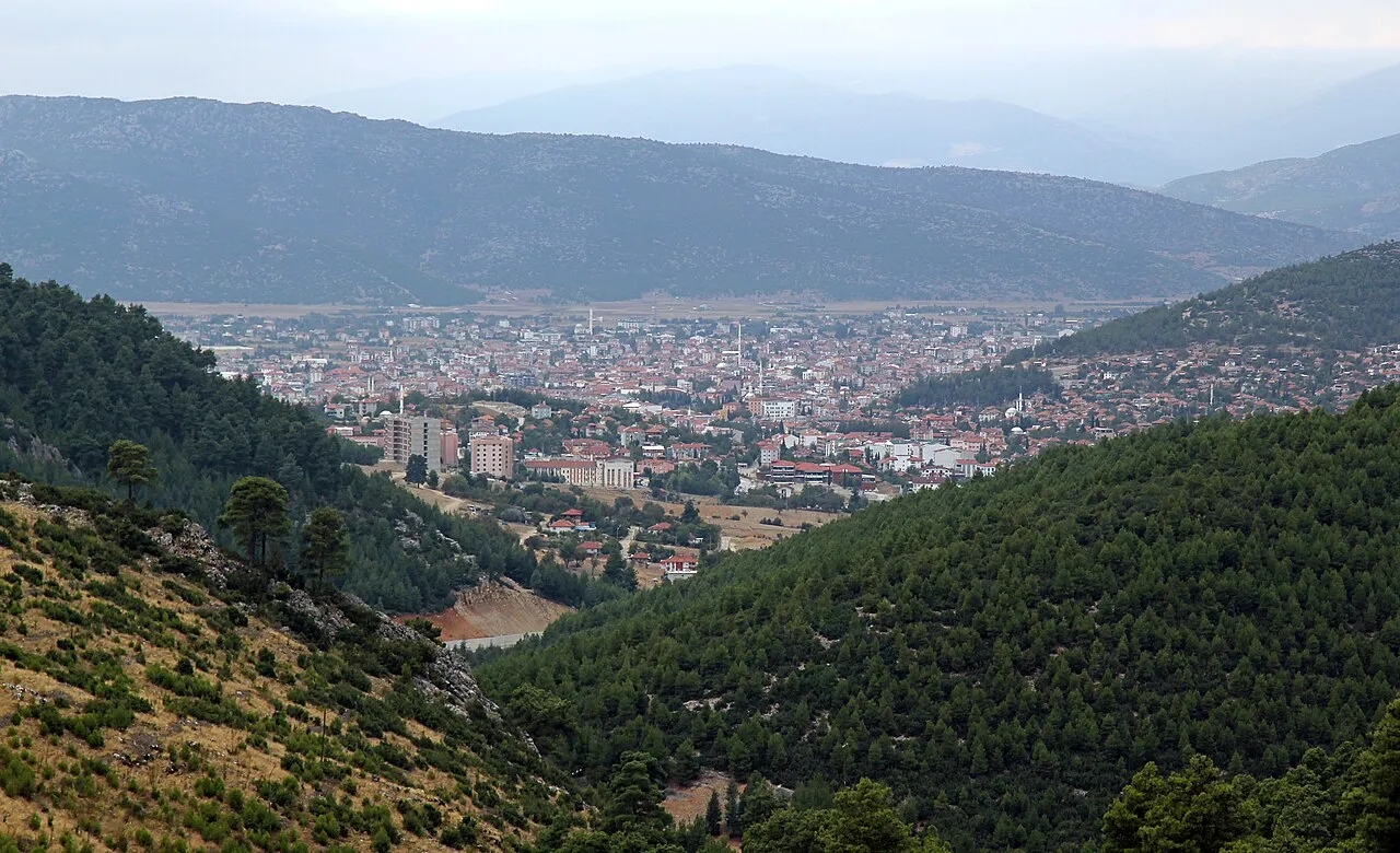
Bucak is a city. Location: Bucak İlçesi, Burdur Province. Population: 29,234. Elevation: 819 m.
Bucak (literally "sheltered nook" or "corner" in Turkish) is a town in Burdur Province, Turkey. It is the seat of Bucak District. Its population is 45,865 (2021), making it the second-most populous municipality of Burdur Province. It was formerly named "Oğuzhan"; the name was changed on 30 May 1926. It is said that the name Oğuzhan came from the Oghuz Turks who settled in this town. Bucak has good connections to other parts of Turkey.
Source: Wikipedia · CC BY-SA 4.0
Photos of Bucak
-

yıldırım perde mefru… · CC BY 3.0

Climate of Bucak
Best months for sightseeingBest months for sightseeing: May, October.
This month · November
Outside the best season
Day 15° · Night 3° · Rain 50 mm
Better nearby cities in November
- Alanya · 161 km southeast21°
- Aydin · 246 km west19°
- Silifke · 320 km east21°
- Hottest month
- July (day 32°)
- Coldest month
- January (night -1°)
- Wettest month
- December (78 mm)
- Driest month
- July (12 mm)
Bars: average monthly low and high temperature. Below: precipitation. Monthly averages for 1970–2000 at about 18 km resolution, adjusted for elevation. Highlighted months are mild and relatively dry. Source: WorldClim 2.1 (CC BY 4.0).
Show values as a table
| Month | Jan | Feb | Mar | Apr | May | Jun | Jul | Aug | Sep | Oct | Nov | Dec |
|---|---|---|---|---|---|---|---|---|---|---|---|---|
| Average high (°C) | 8° | 9° | 13° | 18° | 23° | 28° | 32° | 32° | 28° | 22° | 15° | 10° |
| Average low (°C) | -1° | 0° | 2° | 6° | 10° | 14° | 17° | 16° | 12° | 8° | 3° | 1° |
| Precipitation (mm) | 77 | 69 | 55 | 48 | 46 | 28 | 12 | 12 | 13 | 40 | 50 | 78 |
How to get to Bucak
The nearest airport is Süleyman Demirel International Airport (ISE), 48 km to the northwest as the crow flies. For international flights: Antalya International Airport (AYT) (65 km). The nearest large city is Isparta, 34 km to the north.
Airports
- Süleyman Demirel International Airport (ISE) Isparta 48 kmnorthwest
- Antalya International Airport (AYT) Antalya 65 kmsouth
- Çardak Airport (DNZ) Denizli 87 kmnorthwest
Nearby large cities
- Isparta Population: 172.3K 34 kmnorth
- Antalya Population: 1.3M 62 kmsouth
- Muratpaşa Population: 450K 65 kmsouth
- Denizli Population: 313.2K 138 kmwest
- Merkezefendi Population: 280.3K 142 kmwest
Straight-line distances; road distances are longer. Airport data: OurAirports.
Day trips from Bucak
Within 100 km: 59 historic and cultural sites, 706 natural sites, 250 lakes, rivers and coasts.
0–25 km37 places
- Koca Göl Lake 15 kmN
- Tekçalı Tepe Mountain 17 kmNE
- Kumukalan Dağ Mountain 23 kmSE
- Kulübe Tepe Mountain 23 kmW
25–60 km204 places
- Can Adası Island 52 kmNE
- Lake Yarışlı Lake 57 kmW
- Pınarbaşı Gölü Lake 47 kmW
- Kovada Gölü Lake 32 kmNE
60–100 km774 places
- Konyaaltı Plajı Beach 66 kmS
- Bambus Plajı Beach 67 kmS
- Kumköy Plajı Beach 73 kmSE
- Özlü Plajı Beach 73 kmSE
Straight-line distances.
Nearby attractions & nature
Everything nearby-
Onaç Çayı River, Burdur Province2.8 km W
-
Onaç River, Burdur Province4.8 km NW
-
Aladağ Tepesi Mountain, Bucak İlçesi7.5 km SW
-
Kızıl Tepe Mountain, Bucak İlçesi9.6 km NE
-
Boğadiç Dağı Mountain, Bucak İlçesi9.7 km E
-
Mount Katran Mountain, Bucak İlçesi10 km S
-
Kremna Historic site, Bucak İlçesi9.5 km NE
-
Kayış Deresi River, Burdur Province7.5 km NW
Sources & licences
Data last updated: · 2 independent sources