Tepe Bucağı
Located in Diyarbakır Province, Turkey Coordinates: 37°47′36″ N 40°46′37″ E
- Elevation
- 536 m
- above sea level
- Local time
- UTC+03:00
- Europe/Istanbul · UTC+03:00
- Airports
- BAL Batman Airport33 km
- DIY Diyarbakır Airport52 km
About Tepe Bucağı
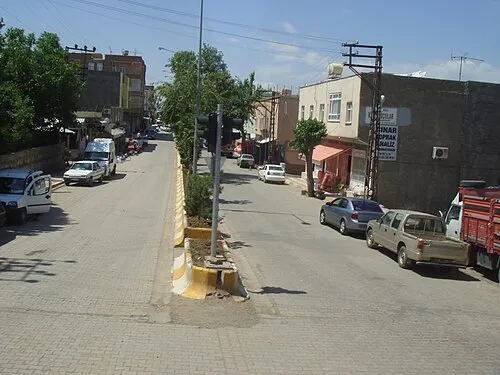
Tepe Bucağı is a municipality. Location: Diyarbakır Province, Turkey. Elevation: 536 m. The best months to visit are April–May, October. The nearest airport is Batman Airport (33 km). Nearby sights include Ziyaret Tepesi and Belkiato Tepesi.
Climate of Tepe Bucağı
Best months for sightseeingBest months for sightseeing: April–May, October.
This month · November
Outside the best season
Day 17° · Night 5° · Rain 62 mm
Better nearby cities in November
- Kızıltepe · 70 km south19°
- Viranşehir · 110 km southwest18°
- Cizre · 134 km east20°
- Hottest month
- July (day 40°)
- Coldest month
- January (night -1°)
- Wettest month
- January (91 mm)
- Driest month
- July (1 mm)
Bars: average monthly low and high temperature. Below: precipitation. Monthly averages for 1970–2000 at about 18 km resolution, adjusted for elevation. Highlighted months are mild and relatively dry. Source: WorldClim 2.1 (CC BY 4.0).
Show values as a table
| Month | Jan | Feb | Mar | Apr | May | Jun | Jul | Aug | Sep | Oct | Nov | Dec |
|---|---|---|---|---|---|---|---|---|---|---|---|---|
| Average high (°C) | 8° | 10° | 16° | 22° | 28° | 35° | 40° | 39° | 35° | 26° | 17° | 10° |
| Average low (°C) | -1° | 0° | 4° | 8° | 13° | 18° | 22° | 21° | 16° | 11° | 5° | 1° |
| Precipitation (mm) | 91 | 88 | 88 | 79 | 40 | 8 | 1 | 1 | 3 | 35 | 62 | 88 |
How to get to Tepe Bucağı
The nearest airport is Batman Airport (BAL), 33 km to the northeast as the crow flies. The nearest large city is Batman, 33 km to the east.
Airports
- Batman Airport (BAL) Batman 33 kmnortheast
- Diyarbakır Airport (DIY) Diyarbakır 52 kmwest
- Mardin Airport (MQM) Mardin 65 kmsouth
Nearby large cities
- Batman Population: 452.2K 33 kmeast
- Diyarbakır Population: 1.8M 51 kmwest
- Mardin Population: 129.9K 53 kmsouth
- Kızıltepe Population: 150.2K 69 kmsouth
- Siirt Population: 114K 104 kmeast
Straight-line distances; road distances are longer. Airport data: OurAirports.
Day trips from Tepe Bucağı
Within 100 km: 219 historic and cultural sites, 1,096 natural sites, 389 lakes, rivers and coasts.
0–25 km290 places
- Sabun Gölü Lake 10 kmNE
- Çiftgöller Lake 11 kmNE
- İbrahim Göl Lake 7 kmN
- Soğan Göl Lake 8 kmN
25–60 km631 places
- Kışlak Historic site 35 kmSE
- Kırkat Göleti Lake 56 kmSE
- Batman Barajı Lake 57 kmNE
- Göksu Barajı Lake 32 kmSW
60–100 km783 places
- Devegeçidi Barajı Lake 76 kmNW
- Bastokan Gölü Lake 71 kmE
- Siirtari Gölü Lake 72 kmE
- Gusır Gölü Lake 92 kmE
Straight-line distances.
Nearby attractions & nature
Everything nearby-
Ziyaret Tepesi Mountain, Bismil İlçesi1.3 km E
-
Belkiato Tepesi Mountain, Bismil İlçesi3.4 km SE
-
İncir Kaynak Natural site, Diyarbakır Province3.7 km S
-
Kaya Tepe Mountain, Bismil İlçesi3.2 km N
-
Gergeri Pınarı Natural site, Diyarbakır Province4.1 km W
-
Harabe Pınarı Natural site, Diyarbakır Province4.2 km SW
-
Kayalı Tepe Mountain, Bismil İlçesi4.4 km NW
-
Ardişırika Tepesi Mountain, Bismil İlçesi4.8 km SE
Other cities and towns in Diyarbakır Province
-
Bismil City, Bismil İlçesi12 km NW
-
Salat Town, Bismil İlçesi11 km NE
-
Salat Bucağı Municipality, Diyarbakır Province12 km NE
-
Bismil Bucağı Municipality, Diyarbakır Province12 km NW
-
 Çınar City, Çınar İlçesi34 km W
-
Diyarbakır City, Diyarbakır Province51 km W
Sources & licences
Data last updated: