Köprüköy Bucağı
Located in Erzurum Province, Turkey Coordinates: 39°57′58″ N 41°52′06″ E
- Elevation
- 1,599 m
- above sea level
- Local time
- UTC+03:00
- Europe/Istanbul · UTC+03:00
- Airports
- ERZ Erzurum International Airport60 km
- AJI Ağrı Airport105 km
About Köprüköy Bucağı
Köprüköy Bucağı is a municipality. Location: Erzurum Province, Turkey. Elevation: 1,599 m. The best months to visit are June, September. The nearest airport is Erzurum International Airport (60 km). Nearby sights include Hasankale Çayı and Çobandede Tepesi.
Climate of Köprüköy Bucağı
Best months for sightseeingBest months for sightseeing: June, September.
This month · November
A cold month
Day 7° · Night -3° · Rain 41 mm
Better nearby cities in November
- Cizre · 294 km south20°
- Silopi · 307 km south20°
- Kızıltepe · 329 km south19°
- Hottest month
- August (day 29°)
- Coldest month
- January (night -13°)
- Wettest month
- May (70 mm)
- Driest month
- September (18 mm)
Bars: average monthly low and high temperature. Below: precipitation. Monthly averages for 1970–2000 at about 18 km resolution, adjusted for elevation. Highlighted months are mild and relatively dry. Source: WorldClim 2.1 (CC BY 4.0).
Show values as a table
| Month | Jan | Feb | Mar | Apr | May | Jun | Jul | Aug | Sep | Oct | Nov | Dec |
|---|---|---|---|---|---|---|---|---|---|---|---|---|
| Average high (°C) | -4° | -2° | 4° | 13° | 18° | 23° | 29° | 29° | 25° | 16° | 7° | 0° |
| Average low (°C) | -13° | -12° | -6° | 2° | 6° | 9° | 12° | 12° | 7° | 3° | -3° | -9° |
| Precipitation (mm) | 28 | 33 | 41 | 59 | 70 | 48 | 25 | 19 | 18 | 46 | 41 | 30 |
How to get to Köprüköy Bucağı
The nearest airport is Erzurum International Airport (ERZ), 60 km to the west as the crow flies. The nearest large city is Erzurum, 51 km to the west.
Airports
- Erzurum International Airport (ERZ) Erzurum 60 kmwest
- Ağrı Airport (AJI) Ağrı 105 kmeast
- Kars Airport (KSY) Kars 125 kmnortheast
Nearby large cities
- Erzurum Population: 767.8K 51 kmwest
- Ağrı Population: 124.5K 104 kmeast
- Rize Population: 119.8K 164 kmnorthwest
- Bingoel Population: 128.9K 169 kmsouthwest
- Iğdır Population: 101.7K 186 kmeast
Straight-line distances; road distances are longer. Airport data: OurAirports.
Day trips from Köprüköy Bucağı
Within 100 km: 9 historic and cultural sites, 728 natural sites, 424 lakes, rivers and coasts.
0–25 km35 places
- Nalbant Dağı Mountain 24 kmSW
- Göçür Dağı Mountain 21 kmSE
- Çobandede Tepesi Mountain 3 kmNE
- Akbaba Dağı Mountain 13 kmSW
25–60 km191 places
- Yıldırım Dağı Mountain 53 kmSW
- Mirgemir Dağı Mountain 46 kmSE
- Kurusababa Tepesi Mountain 52 kmSW
- Konakgörmez Dağı Mountain 57 kmSW
60–100 km935 places
- Seki Gölü Lake 91 kmSW
- Kaz Gölü Lake 80 kmSE
- Lake Akdoğan Lake 92 kmS
- Tortum Gölü Lake 76 kmN
Straight-line distances.
Nearby attractions & nature
Everything nearby-
Hasankale Çayı River, Erzurum Province1.9 km E
-
Çobandede Tepesi Mountain, Köprüköy İlçesi3.3 km NE
-
Kızılçermik Natural site, Erzurum Province5.8 km N
-
Kışla Deresi River, Erzurum Province7.3 km NW
-
Nalbant Deresi River, Erzurum Province9.5 km W
-
Masat Deresi River, Erzurum Province10 km W
-
Kilise Deresi River, Erzurum Province12 km W
-
Tımar Çayı River, Erzurum Province12 km W
Other cities and towns in Erzurum Province
-
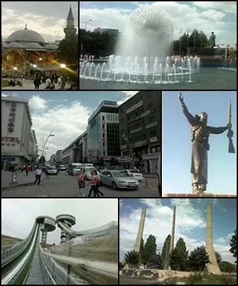 Erzurum City, Erzurum Province51 km W
-
Pasinler City, Pasinler İlçesi17 km W
-
Pasinler Bucağı Municipality, Erzurum Province17 km W
-
Horasan City, Horasan İlçesi26 km E
-
Söylemez Bucağı Municipality, Erzurum Province23 km S
-
Horasan Bucağı Municipality, Erzurum Province26 km E
Sources & licences
Data last updated: