Söylemez Bucağı
Located in Erzurum Province, Turkey Coordinates: 39°45′59″ N 41°48′17″ E
- Elevation
- 1,771 m
- above sea level
- Local time
- UTC+03:00
- Europe/Istanbul · UTC+03:00
- Airports
- ERZ Erzurum International Airport58 km
- AJI Ağrı Airport105 km
About Söylemez Bucağı
Söylemez Bucağı is a municipality. Location: Erzurum Province, Turkey. Elevation: 1,771 m. The best months to visit are June, September. The nearest airport is Erzurum International Airport (58 km). Nearby sights include Çullu Çay and Karasu Çayı.
Climate of Söylemez Bucağı
Best months for sightseeingBest months for sightseeing: June, September.
This month · November
A cold month
Day 7° · Night -3° · Rain 53 mm
Better nearby cities in November
- Cizre · 273 km south20°
- Silopi · 286 km south20°
- Kızıltepe · 306 km south19°
- Hottest month
- August (day 28°)
- Coldest month
- January (night -12°)
- Wettest month
- May (81 mm)
- Driest month
- August (20 mm)
Bars: average monthly low and high temperature. Below: precipitation. Monthly averages for 1970–2000 at about 18 km resolution, adjusted for elevation. Highlighted months are mild and relatively dry. Source: WorldClim 2.1 (CC BY 4.0).
Show values as a table
| Month | Jan | Feb | Mar | Apr | May | Jun | Jul | Aug | Sep | Oct | Nov | Dec |
|---|---|---|---|---|---|---|---|---|---|---|---|---|
| Average high (°C) | -3° | -2° | 2° | 11° | 17° | 22° | 28° | 28° | 24° | 16° | 7° | 0° |
| Average low (°C) | -12° | -11° | -6° | 1° | 5° | 9° | 12° | 12° | 8° | 3° | -3° | -8° |
| Precipitation (mm) | 37 | 43 | 52 | 76 | 81 | 48 | 24 | 20 | 21 | 57 | 53 | 42 |
How to get to Söylemez Bucağı
The nearest airport is Erzurum International Airport (ERZ), 58 km to the west as the crow flies. The nearest large city is Erzurum, 48 km to the west.
Airports
- Erzurum International Airport (ERZ) Erzurum 58 kmwest
- Ağrı Airport (AJI) Ağrı 105 kmeast
- Muş Airport (MSR) Muş 114 kmsouth
Nearby large cities
- Erzurum Population: 767.8K 48 kmwest
- Ağrı Population: 124.5K 106 kmeast
- Bingoel Population: 128.9K 150 kmsouthwest
- Rize Population: 119.8K 177 kmnorthwest
- Iğdır Population: 101.7K 193 kmeast
Straight-line distances; road distances are longer. Airport data: OurAirports.
Day trips from Söylemez Bucağı
Within 100 km: 6 historic and cultural sites, 868 natural sites, 440 lakes, rivers and coasts.
0–25 km42 places
- Nalbant Dağı Mountain 11 kmW
- Göçür Dağı Mountain 21 kmE
- Akbaba Dağı Mountain 12 kmN
- Deliler Tepesi Mountain 25 kmW
25–60 km169 places
- Yıldırım Dağı Mountain 40 kmW
- Mirgemir Dağı Mountain 45 kmE
- Kurusababa Tepesi Mountain 32 kmSW
- Konakgörmez Dağı Mountain 40 kmW
60–100 km1,103 places
- Seki Gölü Lake 68 kmSW
- Lake Haçlı Lake 93 kmSE
- Kaz Gölü Lake 65 kmSE
- Lake Akdoğan Lake 70 kmS
Straight-line distances.
Nearby attractions & nature
Everything nearby-
Çullu Çay River, Erzurum Province1.7 km SE
-
Karasu Çayı River, Erzurum Province5.7 km S
-
Beyaz Tepe Mountain, Köprüköy İlçesi5.2 km N
-
Çağlıkan Deresi River, Erzurum Province6 km S
-
Alacasu Deresi River, Erzurum Province10 km SE
-
Topçu Dağı Mountain, Köprüköy İlçesi11 km NE
-
Elem Dağı Mountain, Karayazı İlçesi13 km SE
-
Kazbil Dağı Mountain, Erzurum Province25 km SE
Other cities and towns in Erzurum Province
-
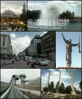 Erzurum City, Erzurum Province48 km W
-
Pasinler City, Pasinler İlçesi26 km NW
-
Hınıs City, Hınıs İlçesi46 km S
-
Köprüköy Bucağı Municipality, Erzurum Province23 km N
-
Tekman City, Tekman İlçesi29 km SW
-
Pasinler Bucağı Municipality, Erzurum Province26 km NW
Sources & licences
Data last updated: