Isparta Province
Local name: Isparta ili
Located in Turkey Coordinates: 38°00′00″ N 31°00′00″ E
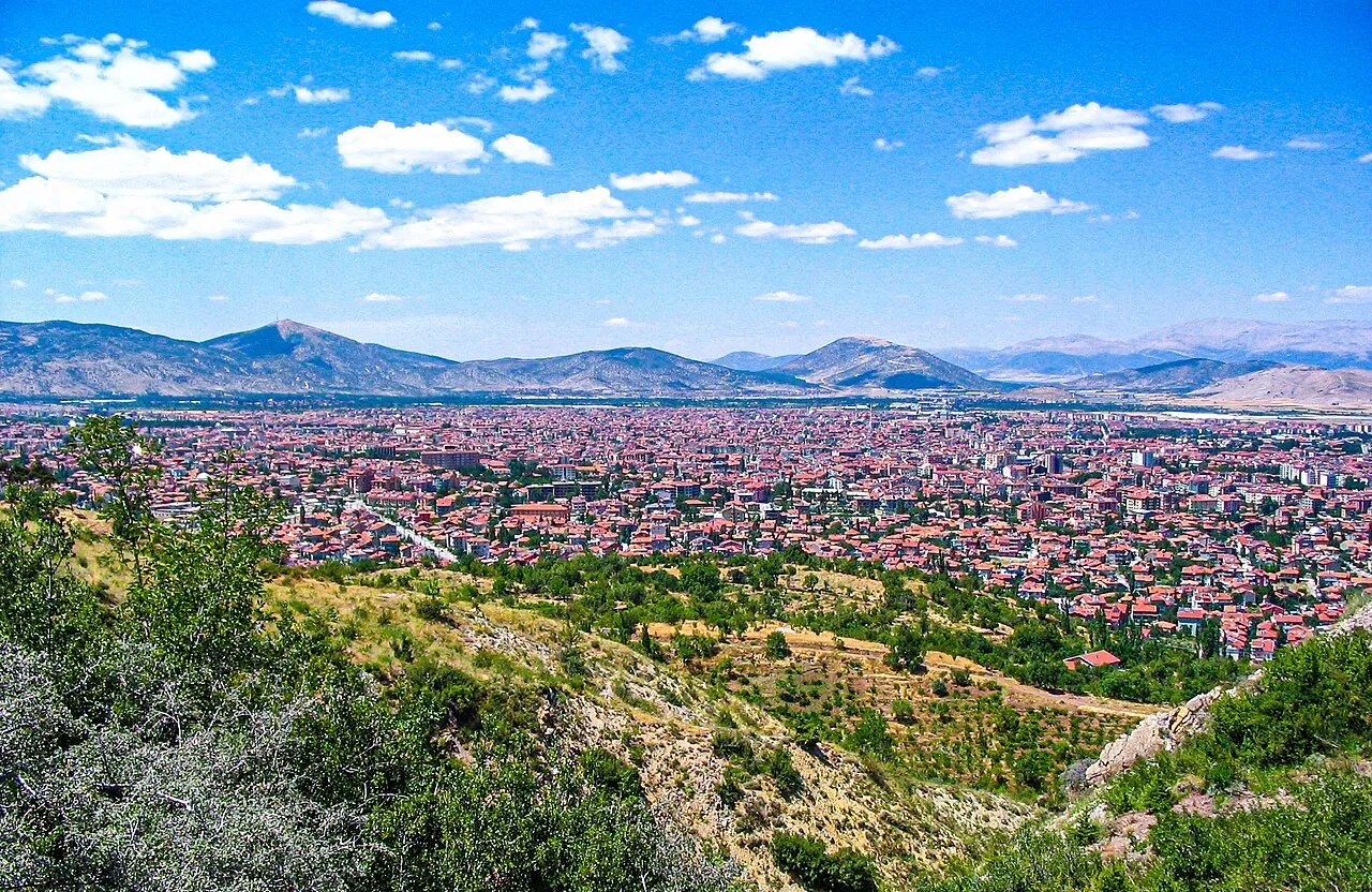
- Population
- 446,409
- 446.4K
- Elevation
- 1,431 m
- above sea level
- Local time
- UTC+03:00
- Europe/Istanbul · UTC+03:00
- Places inside
- 81
- listed under Isparta Province
- Airports
- ISE Süleyman Demirel International Airport58 km
- DNZ Çardak Airport117 km
About Isparta Province
Isparta Province is a region. Location: Turkey. Population: 446,409.
Isparta Province (Turkish: Isparta ili) is a province in southwestern Turkey. Its adjacent provinces are Afyon to the northwest, Burdur to the southwest, Antalya to the south, and Konya to the east. Its area is 8,946 km2, and its population is 445,325 (2022). The provincial capital is Isparta. The province is well known for producing apples, sour cherries, grapes, roses and rose products, and carpets. The best fertile lands are in Uluborlu.
Source: Wikipedia · CC BY-SA 4.0
Photos of Isparta Province
-
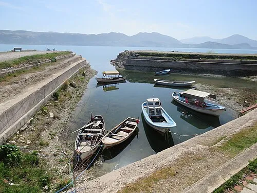
Yeşil Ada Calistemon · CC BY-SA 4.0

Places bordering Isparta Province
- Konya Province
- Afyonkarahisar Province
- Antalya Province
- Burdur Province
Climate of Isparta Province
Best months for sightseeingBest months for sightseeing: June, September.
This month · November
A cold month
Day 11° · Night 1° · Rain 51 mm
Better nearby cities in November
- Alanya · 185 km southeast21°
- Aydin · 278 km west19°
- Silifke · 316 km southeast21°
- Hottest month
- July (day 28°)
- Coldest month
- January (night -5°)
- Wettest month
- December (86 mm)
- Driest month
- August (13 mm)
Bars: average monthly low and high temperature. Below: precipitation. Monthly averages for 1970–2000 at about 18 km resolution, adjusted for elevation. Highlighted months are mild and relatively dry. Source: WorldClim 2.1 (CC BY 4.0).
Show values as a table
| Month | Jan | Feb | Mar | Apr | May | Jun | Jul | Aug | Sep | Oct | Nov | Dec |
|---|---|---|---|---|---|---|---|---|---|---|---|---|
| Average high (°C) | 3° | 4° | 8° | 14° | 20° | 24° | 28° | 28° | 24° | 17° | 11° | 5° |
| Average low (°C) | -5° | -4° | -1° | 4° | 8° | 11° | 14° | 13° | 10° | 5° | 1° | -2° |
| Precipitation (mm) | 79 | 69 | 65 | 66 | 60 | 41 | 16 | 13 | 17 | 43 | 51 | 86 |
How to get to Isparta Province
The nearest airport is Süleyman Demirel International Airport (ISE), 58 km to the west as the crow flies. For international flights: Antalya International Airport (AYT) (123 km). The nearest large city is Isparta, 47 km to the southwest.
Airports
- Süleyman Demirel International Airport (ISE) Isparta 58 kmwest
- Çardak Airport (DNZ) Denizli 117 kmwest
- Antalya International Airport (AYT) Antalya 123 kmsouth
Nearby large cities
- Isparta Population: 172.3K 47 kmsouthwest
- Afyonkarahisar Population: 251.8K 93 kmnorthwest
- Antalya Population: 1.3M 124 kmsouth
- Muratpaşa Population: 450K 125 kmsouth
- Konya Population: 1.4M 131 kmeast
Straight-line distances; road distances are longer. Airport data: OurAirports.
Places in Isparta Province
81 places- 1 Yalvaç İlçesi 50.3K
- 2 Eğirdir İlçesi 33.5K
- 3 Şarkîkaraağaç İlçesi 26.6K
- 4 Gelendost İlçesi 16.4K
- 5 Keçiborlu İlçesi 14.6K
- 6 Senirkent İlçesi 12.9K
- 7 Sütçüler İlçesi 11.6K
- 8 Gönen İlçesi 8.1K
- 9 Uluborlu İlçesi 7.3K
- 10 Atabey İlçesi 5.6K
- 11 Aksu İlçesi 5K
- 12 Yenişarbademli İlçesi 2.5K
Bar: population relative to the most populous place in this list.
Countries & regions1
- Isparta · District
Cities & villages10
- Atabey Bucağı · Municipality
- Bağkonak Bucağı · Municipality
- Barla Bucağı · Municipality
- Eğirdir Bucağı · Municipality
- Gelendost Bucağı · Municipality
- Gönen Bucağı · Municipality
- Karamusalar · Village
- Kasımlar Bucağı · Municipality
- Keçiborlu Bucağı · Municipality
- Kumdanlı Bucağı · Municipality
Mountains & nature13
- Adrildağları · Mountain
- Aygır Çeşmesi · Natural site
- Bağlancı Boğazı · Natural site
- Barla Dağı · Mountain
- Çamormanı · Natural site
- Çiçekdağları · Mountain
- Dumlu Çeşmesi · Natural site
- Kale Boğazı · Natural site
- Karakoru Çeşmesi · Natural site
- Karamahmut Çeşmesi · Natural site
- Kömürcü Tepe · Mountain
- Kömürcü Tepesi · Mountain
- Kürtoluğuormanı · Natural site
Lakes, rivers & coasts24
- Akçay Deresi · River
- Aksu Çayı · River
- Başak Deresi · River
- Boğaziçi Deresi · River
- Can Adası · Island
- Çukur Deresi · River
- Darı Derersi · River
- Darıklar Çayı · River
- Darıören Derersi · River
- Değirmen Dere · River
- Doğan Dere · River
- Eleksu · River
- Fabrika Çayı · River
- Giresun Deresi · River
- Göçek Deresi · River
- Gölcük Gölü · Lake
- İğdeli Ada · Island
- Keçiborlu Çayı · River
- Koca Dere · River
- Kovada Gölü · Lake
- Köydere · River
- Kozağacı Deresi · River
- Kuzukulağı Deresi · River
- Lake Eğirdir · Lake
Largest cities and towns
-
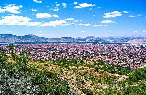 Isparta City, Isparta172.3K
-
Gönen City, Gönen İlçesi14.1K
-
Yalvaç City, Yalvaç İlçesi39.1K
-
Şarkîkaraağaç City, Şarkîkaraağaç İlçesi32.8K
-
Eğirdir Town, Eğirdir İlçesi16.9K
-
Atabey City, Atabey İlçesi12.7K
-
Uluborlu City, Uluborlu İlçesi12.5K
-
Gökçehüyük Village, Eğirdir İlçesi2.2K
Nature and heritage in Isparta Province
Sources & licences
Data last updated: · 2 independent sources