İğdir Bucağı
Located in Kastamonu Province, Turkey Coordinates: 41°14′13″ N 33°09′23″ E
- Elevation
- 650 m
- above sea level
- Local time
- UTC+03:00
- Europe/Istanbul · UTC+03:00
- Airports
- KFS Kastamonu Airport54 km
- ONQ Zonguldak Çaycuma Airport94 km
About İğdir Bucağı
İğdir Bucağı is a municipality. Location: Kastamonu Province, Turkey. Elevation: 650 m. The best months to visit are May–June, September. The nearest airport is Kastamonu Airport (54 km). Nearby sights include Çengelli Dere and Çatak Deresi.
Climate of İğdir Bucağı
Best months for sightseeingBest months for sightseeing: May–June, September.
This month · November
A cold month
Day 12° · Night 2° · Rain 50 mm
- Hottest month
- July (day 28°)
- Coldest month
- January (night -2°)
- Wettest month
- May (73 mm)
- Driest month
- September (30 mm)
Bars: average monthly low and high temperature. Below: precipitation. Monthly averages for 1970–2000 at about 18 km resolution, adjusted for elevation. Highlighted months are mild and relatively dry. Source: WorldClim 2.1 (CC BY 4.0).
Show values as a table
| Month | Jan | Feb | Mar | Apr | May | Jun | Jul | Aug | Sep | Oct | Nov | Dec |
|---|---|---|---|---|---|---|---|---|---|---|---|---|
| Average high (°C) | 4° | 7° | 11° | 17° | 21° | 25° | 28° | 28° | 24° | 18° | 12° | 6° |
| Average low (°C) | -2° | -1° | 1° | 5° | 9° | 12° | 14° | 14° | 10° | 7° | 2° | -1° |
| Precipitation (mm) | 63 | 48 | 51 | 60 | 73 | 53 | 36 | 32 | 30 | 43 | 50 | 70 |
How to get to İğdir Bucağı
The nearest airport is Kastamonu Airport (KFS), 54 km to the east as the crow flies. For international flights: Esenboğa International Airport (ESB) (124 km). The nearest large city is Karabük, 44 km to the west.
Airports
- Kastamonu Airport (KFS) Kastamonu 54 kmeast
- Zonguldak Çaycuma Airport (ONQ) Zonguldak 94 kmwest
- Esenboğa International Airport (ESB) Ankara 124 kmsouth
Nearby large cities
- Karabük Population: 125.4K 44 kmwest
- Kastamonu Population: 125.6K 54 kmeast
- Zonguldak Population: 101.7K 117 kmwest
- Bolu Population: 184.7K 142 kmsouthwest
- Ankara Population: 3.5M 148 kmsouth
Straight-line distances; road distances are longer. Airport data: OurAirports.
Day trips from İğdir Bucağı
Within 100 km: 7 historic and cultural sites, 306 natural sites, 211 lakes, rivers and coasts.
0–25 km47 places
- Keltepe Mountain 11 kmN
- Karlık Tepe Mountain 20 kmSW
- Karamanlar Tepesi Mountain 21 kmSW
- Göktepe Mountain 15 kmN
25–60 km162 places
- Büyük Göl Lake 46 kmS
- Bozoğlu Göleti Lake 55 kmS
- Zeytinlik Tepesi Mountain 60 kmN
- Yayla Tepesi Mountain 37 kmSE
60–100 km315 places
- Büyük Ada Island 86 kmNW
- Koca Gölü Lake 74 kmSW
- Keçi Gölü Lake 75 kmSW
- Terzili Göleti Lake 75 kmNE
Straight-line distances.
Nearby attractions & nature
Everything nearby-
Çengelli Dere River, Kastamonu Province2.1 km SW
-
Çatak Deresi River, Kastamonu Province4.3 km W
-
Çatak Deresi River, Kastamonu Province4.7 km W
-
Asar Deresi River, Kastamonu Province4.9 km E
-
Abdal Tepe Mountain, Araç İlçesi5.2 km N
-
Kara Dere River, Kastamonu Province8.1 km W
-
Kartal Suyu Natural site, Kastamonu Province12 km S
-
Bakacak Dağı Mountain, Araç İlçesi10 km NE
Other cities and towns in Kastamonu Province
-
Araç City, Araç İlçesi14 km E
-
Araç Bucağı Municipality, Kastamonu Province14 km E
-
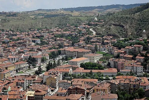 Kastamonu City, Cide54 km E
-
Pınarbaşı City, Pınarbaşı İlçesi41 km N
-
Boyalı Bucağı Municipality, Kastamonu Province26 km SE
-
Akkaya Bucağı Municipality, Kastamonu Province28 km E
Sources & licences
Data last updated: